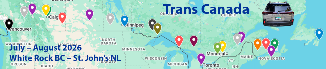
Is it the Trans Canada or Highway 1? Well, that depends on where you are! The Trans Canada is a series of contiguous highways that stretch from Victoria at the bottom of Vancouver Island BC to St John’s Newfoundland. For much of the Western sections it is Highway 1, in Ontario it’s Highway 17 and in Nova Scotia and Newfoundland it’s Highway 104. From Vancouver to the start of the Selkirk mountain range it’s 2 lanes each side, but over the Rockies it’s mostly one lane until Calgary. Then it varies by Province
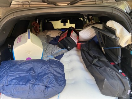
I left home at 07:30 with the car packed to the gunwales with clothes and everything I would need to survive in the wild and sleep in the car. I had a blow up mattress that just about squeezed into the rear with the back seats down, survival rations left over from my Arctic trip in 2023, first aid kit, spare car battery, bear spray and Bowie knife, tools and torches.
God only knows how much that all weighed and the extra gas it would burn!
To get to the Trans Canada Highway 1 I had to head East from home on 8th Avenue in South Surrey, BC but there was a slight problem… like many roads in the BC Lower Mainland, 8th Avenue wasn’t contiguous, so I would have to head North up to 16th Avenue and use that to cover the gap in 8th Avenue before dropping down South again to regain my original route. It turned out that this was clearly beyond dear Siri’s comprehension as she insisted on sending me up and down the highways, finally joining Highway 1 West of Abbotsford airport instead of East of it where the morning traffic was lighter.
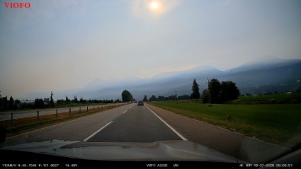
By the time I got on to Highway 1 I was wondering why the sky was a strange burnt orange colour. By Chilliwack the sky was much darker and there was an acrid taste in the air inside the car even with the air conditioning on. Then the news came over the radio that Highway 1 was closed between Boston Bar and Lytton further North.
I wasn’t bothered by the road closure as I wasn’t going up that section of Highway 1, which heads North, then East like two sides of a right angle triangle, and Highway 5 was the “hypotenuse” shortcut. But I was bothered that the fires might hit Lytton again. At the end of June 2021 a wildfire destroyed virtually the entire town, two people were killed and hundreds made homeless.
These fires are particularly dangerous because of where they are – in the Fraser River valley. It’s a very steep valley so the wind coming down from the North accelerates and can cause the fires to move very, very quickly.
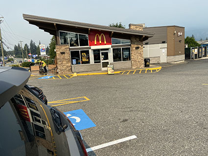
I had left home without eating breakfast, so I had a brunch in Hope, where Highway 1 and Highway 5 part company. I’m ashamed to report that I did indeed eat at a place that is known in my family as Macciedoodahs, but I confined consumption to a Big Mac, or two.
Highway 5 heads North to join Highway 1 again at Kamloops, where the South Thompson river and the North Thompson river join to form the Thompson river. That flows South into the Fraser river at Lytton. The area around Kamloops is obviously a periodic flood plain for the rivers so is very flat and covered in what appeared to be fruit farms.
The route took me alongside the huge Shuswap Lake and then into the start of the Selkirk mountain range. I stayed overnight in Revelstoke in a very forgettable hotel and fell asleep exhausted as soon as I hit the sack.
I got up at 5 am to do some email, then a shower, a cup of tea and on the road at 6 am sharp.
I was quickly into the mountains with some very beautiful scenery approaching Roger’s Pass in the Selkirks range part of the Rockies. I had a great view of the Columbia river, calm and with many islands and sandbanks exposed right now but imagine springtime and the snow melting.
Winters up here can be very cold and there's always heavy snowfall. Keeping the road open requires a host of resources and constant attention.
The railroad follows the river through Roger’s Pass, and it was for the railroad that the pass was first developed, having been discovered in 1881-1882 by Major Rogers.
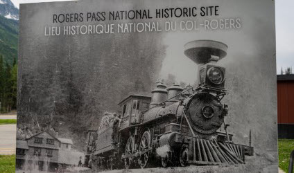
Because of its size and topology Canada is highly dependent on the railroad.
There are very few places to stop on these mountain roads through the Selkirks, and the Rockies and the roads are mostly single track though there are frequent passing lanes when geography permits.
It seemed that at least half the vehicles I encountered were trucks. As I climbed, I noticed that the landscape changed to what definitely looked like the boreal forests that I had encountered on my way up to the Arctic in 2023.
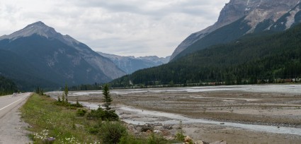
This area of the mountains is at the base of the Boreal Zone so this wasn’t surprising. There were frequent signs to be aware of bear and elk.
I crossed into Alberta and had a break in the town of Banff, a famous ski resort. It was swarming with people and I heard all sorts of languages and accents.
As the mountains ended in a gradual decline to Cochrane and then Calgary, Siri managed to waste an hour of my time with misdirection!
Soon after Calgary I was on the prairies, which were as flat as the Holland I had lived in! I saw rapeseed (confusingly known in the UK as oilseed rape) and other crops that maybe included soya but I hadn’t seen wheat yet.
Finally, I reached a Holiday Inn Express in Medicine Hat, the Houston (oil capital) of Canada. The guy in reception refused to let me pay by points, refused to honor the US$129 in Priceline, then said OK and quoted me CA$200.
I said at even the greediest exchange rate that was nowhere near CA$200. So I went round the corner in the hotel and booked online using points and returned to the front desk. They had no choice to honour the online booking, but were very unhappy bunnies when I explained much better off financially taking my original offer!
Early to bed all while forgetting I had crossed a time zone!
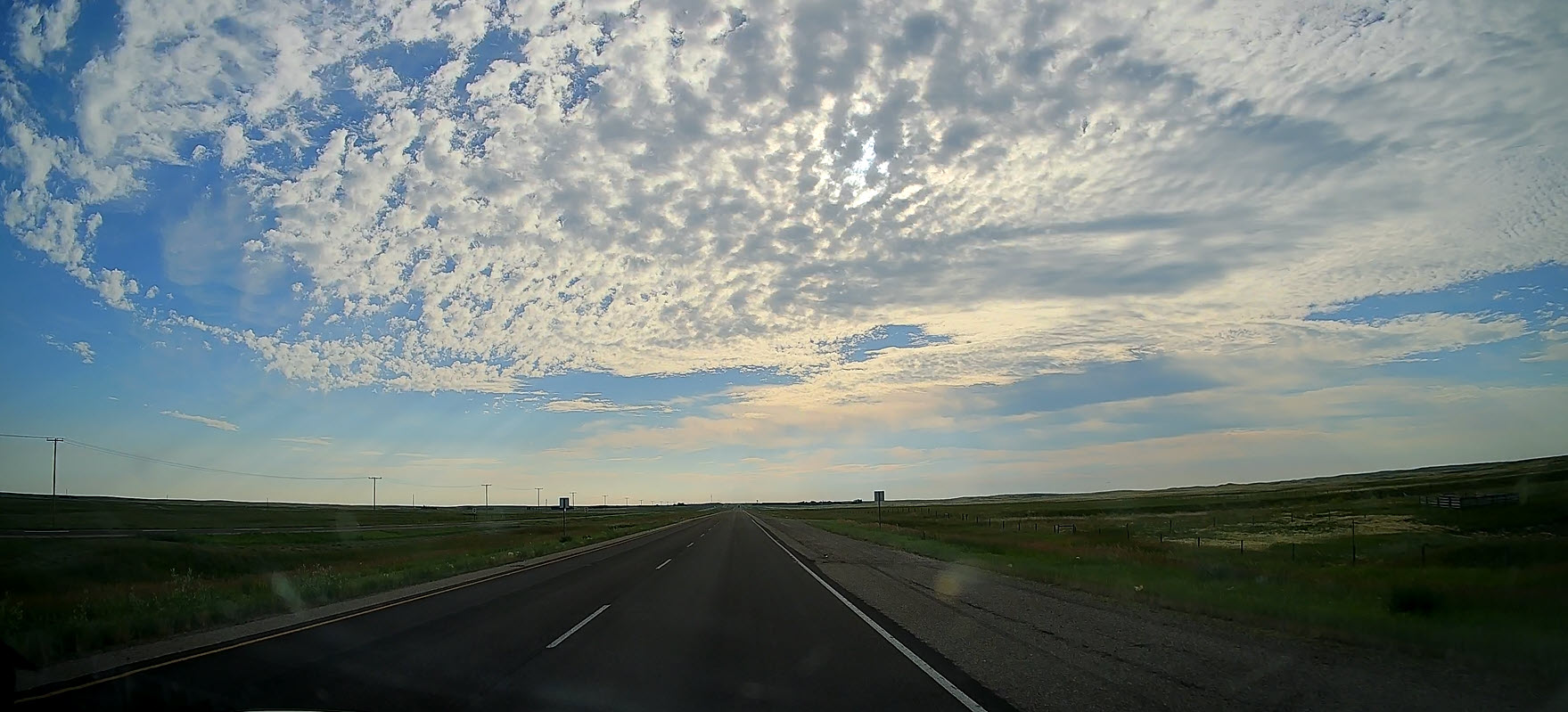
I was up at 5 am to check email and be ready for breakfast at 6 am. Had a quick breakfast then gassed up, which is ~20% cheaper here than at home but then most of Canda’s oil is from Alberta. The sun is rising in the East into a slightly cloudy blue sky.
Once thru Calgary the journey was, well, mega boring, as I knew it would be. 500 miles of almost flat country and divided highway – great for zooming along at 75 mph. In Alberta the divided highway speed limit is generally 110 kph, so 120 kph is unlikely to get you pulled over. The cops aren’t looking for creepies who are just over the limit, but for the maniacs go well above it. That can be very expensive in Canada, including having your vehicle impounded.
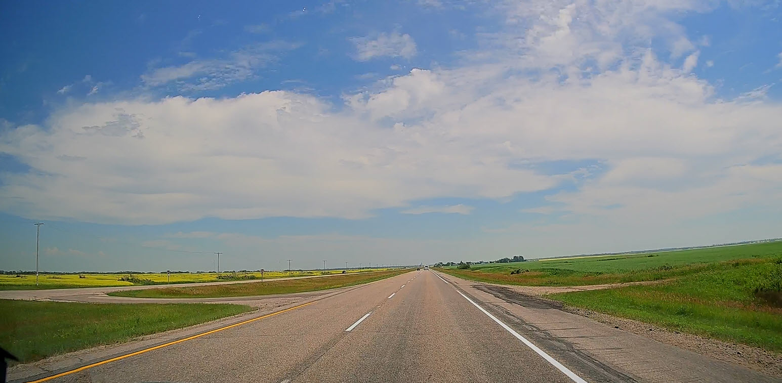
I knew that there was a huge amount of wheat fields on the prairies but saw a mix – wheat, soya, rapeseed and a few areas that looked like peas. Elevators and silos are everywhere, and a two track railroad runs the whole length of the prairies close to Highway 1, so farmers can get crops to East or West coast ports quickly. They can also send truck loads as many of the loading / outbound docks are alongside Highway 1 too.
The prairies seem to be still predominantly green though some golden tips are starting to appear.
Trains around here are very, very long, often with multiple engines and a mix of cargo including wheat grain, other crops, oil and even salt! I’ll cover that more on the return through Manitoba. For crops there are side tracks off the main lines that route cars under the hopper feeder, with the side lines long enough to form a train or large section to be added to an existing train.
In the video on the right the train can be seen in the distance on the right and it them comes much closer to the road. You can see how long it is.
I saw more cars on the road today, and many caravans / trailers too, but even on a Saturday there were still many trucks.
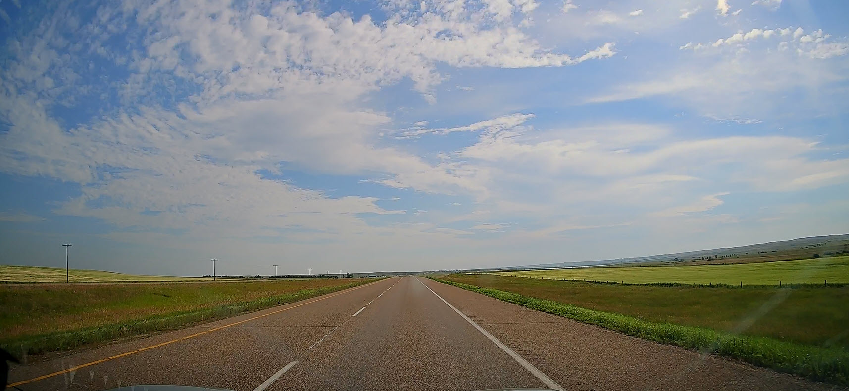
The other oddity is that I was followed by cops in Q (unmarked) cars – three times! I know they were cops because I saw two of them pull out as I went by (slightly over the limit) and I saw cops in all three cars as they passed me. I guess they were just curious about my BC plate and unusual registration (IAN); or did they just think that being so far from home I wasn’t worth the bother? Then I realised that they couldn’t possibly have seen that I had BC plates at the speed I was going and the distance I was from them. I think they were after others in front of me and it was just a conincidence that I came next.
I’m in Brandon, Manitoba tonight, so I have crossed into another province and changed time zones again. I’ll do that again tomorrow as I will cross into Ontario (in fact I got this wrong as the time zone demarcation is near Upsala, 250 miles from the Manitoba/Ontario border).
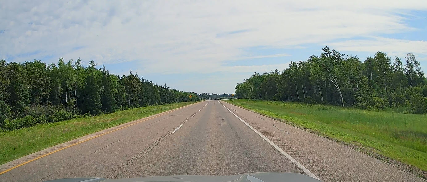
The plan for today was to drive from Brandon Manitoba to Upsala Ontario, but as the Scottish poet Robert Burns once wrote “The best laid schemes o’ mice an’ men. Gang aft a-gley.”
Or in plain English “The best laid plans of mice and men can still go wrong.” And today they certainly did in a big way! Today my best laid schemes gave way to the best laid schemes of Mother Nature, who as you know, always wins.
I set off under relatively clear skies and rapidly rising temperatures that at one point during the afternoon would reach 36° C. There was very little traffic on the road and a marked absence of trucks. This was perhaps not surprising as it is a Sunday today.
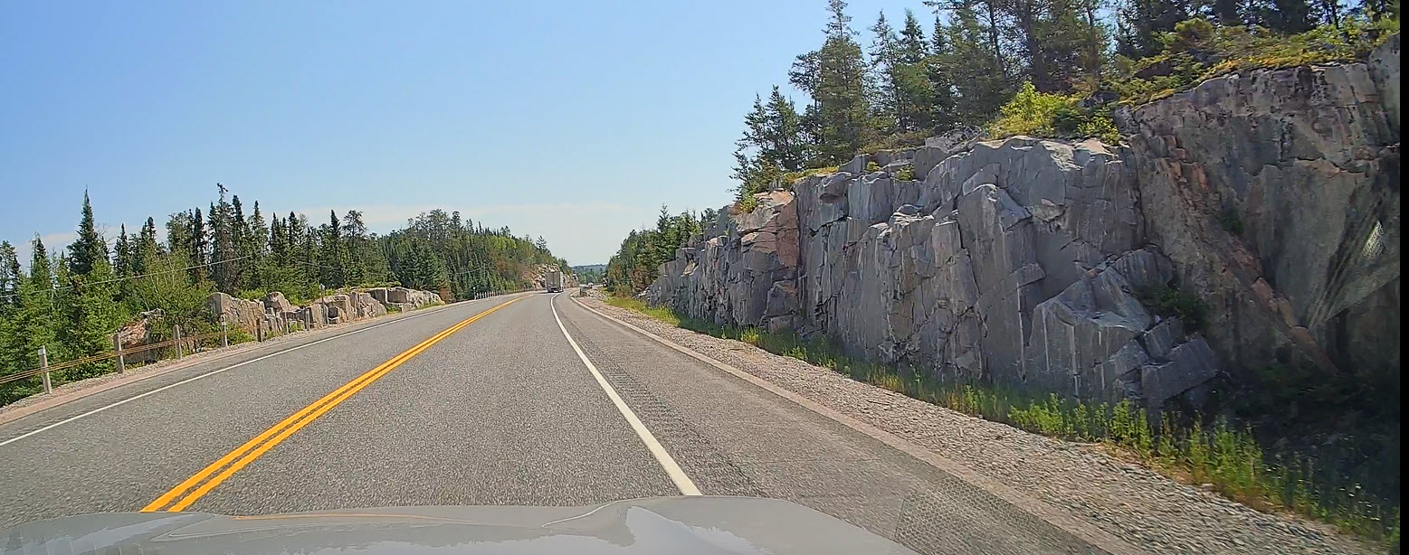
Initially I was on a divided highway and making excellent progress, but within 15 minutes that divided highway became one lane each way. But 10 minutes later the highway divided again (being in Manitoba then it was still Highway 1). Another 10 minutes and back to single lane each way, and it stayed that way. And by now the landscape had transitioned into boreal forest with its distinctive shorter spruce trees. More rock crops lined the road as I was now driving through the Canadian Shield continental crust. I stopped at Dryden ON to gas up and get some lunch.
The woman at the gas station asked me where I was heading so I told her I was going to Upsala. She replied that wherever else I was going today, Upsala wasn’t it as there was a massive fire just North of Highway 1 at Upsala. Now that definitely got my attention! I quickly got back in my Subie to make some phone calls. First was to the accommodation I had booked in Upsala. That conversation didn’t take too long “don’t even think of coming here, it’s far too dangerous, always assuming you can actually see where you’re going in all this smoke. We’ve been told we must be ready to evacuate at 5 minutes notice.” OK, I am definitely not going there!
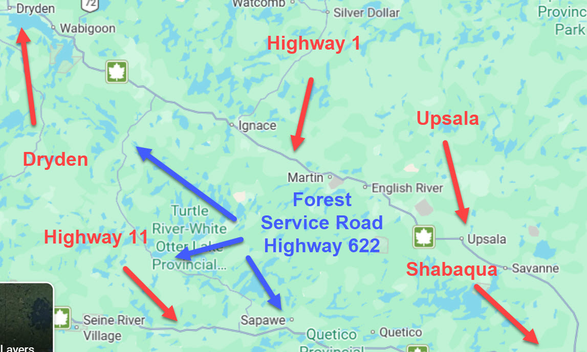
So, I checked all of the local hotels and motels in Dryden – nothing doing because they were all full of folks escaping the fires. So I looked further East and found a sort of camp/motel down Highway 1 at Shabaqua and rang them. She confirmed that Highway 1 was definitely closed from well North of Upsala and told me I would have to backtrack to Kenora, take highway 71 South to highway 11, then head East to Shabaqua where it joins Highway 1.
That would add a mere 180 miles to my journey, which left me a very unhappy camper – where is that map! I found a forest service road which ran from 45 miles Southwest of Dryden to join highway 11 just South of Atikokan. I knew that there were wildfires all over this region and that there may be one or more on 622, but no one had mentioned fires on that road.
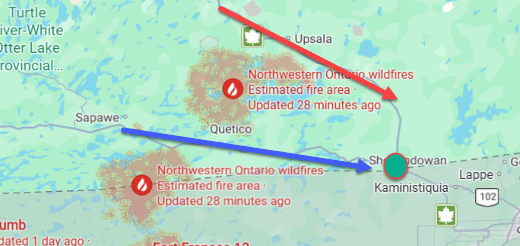
In fact, that road had been closed the week before due to a fire. But I decided to go anyway. What I didn’t know was that there was a major group of fires immediately to the West of 622 and another group just South of highway 11.
I must admit the drive down highway 622 was nervewracking. I could smell smoke but I didn’t know if that was from the fires further North at Upsala or local to where I was. But about 30 miles into the 85 miles to highway 11 I came across a group of forestry workers, who didn’t seem at all bothered about wildfires and danger. Well you guys know this place well, if you’re not scared then I guess I’m not either!
Finally, I hit highway 11 and stopped for a few minutes to reflect on what I had just done. Had fires blocked my path North and South I think I would have been in trouble. But even though I was now on highway 11, I wasn’t totally safe. No one had mentioned the massive fire at Lac des Milel Lacs (Lake of the Thousand Lakes) between Upsala in the North and highway 11 to the South. This video of part of that fire was taken that evening. o see the full lhorror of whaqt was happening click the ⛶ symbol. If you are quick you can just see a lightning flash between 6 - 8 seconds into the video.
This is not a normal thunderstorm, it's one caused by the fire itself which sends so much heat upwards that a special type of clouds, called pyrocumulonimbus, forms and lightning strikes are generated. One reason why very large wildfires are so dangerous is that they can generate lightning strikes which start more fires.
I called the owner of the camp where I would spend the night and confirmed I would be with her at 6 pm. She said probably 7 pm, but I insisted it would be 6 pm. And it would have been had I just ignored the new time zone I would enter just before I reached Shabaqua!
My host made me a very welcome cup of tea, fetched some fruit and biscuits and expressed surprise that highway 622 had been opened. She thought it was still closed, which is why she suggested such a long diversion. I mentioned that I had xhosen Upsala as I wondered if there was any connection to the city of Uppsala in Sweden, which I had visited for work periodically in the 1980's. She confirmed that the town was started by a group of immigrants from Uppsala. I was completely shattered and fell asleep as soon as my head hit that pillow. What a day!
I didn’t hear the storm start overnight but its violent claps of thunder and the crescendo of the rain hitting the window certainly woke me up early this morning. I showered, shaved, dressed and packed ready for the off. I opened front door of the building to a horror story of frequent close lightning flashes and downpour of such magnitude that I could hardly see my vehicle 10 yards away. I got soaked loading up car and left at 6:15. I couldn’t see too much even with the wipers on full speed as they weren’t fully clearing the rain off the windshield.
I gingerly joined Highway 1, but I couldn’t see enough to go above 50 kph. The road went up into hills, and it quickly got misty at which point the rain eased off slightly. Then the mist thickened a lot, with cars taking turns to be the leader, then relieved after about 10 minutes.
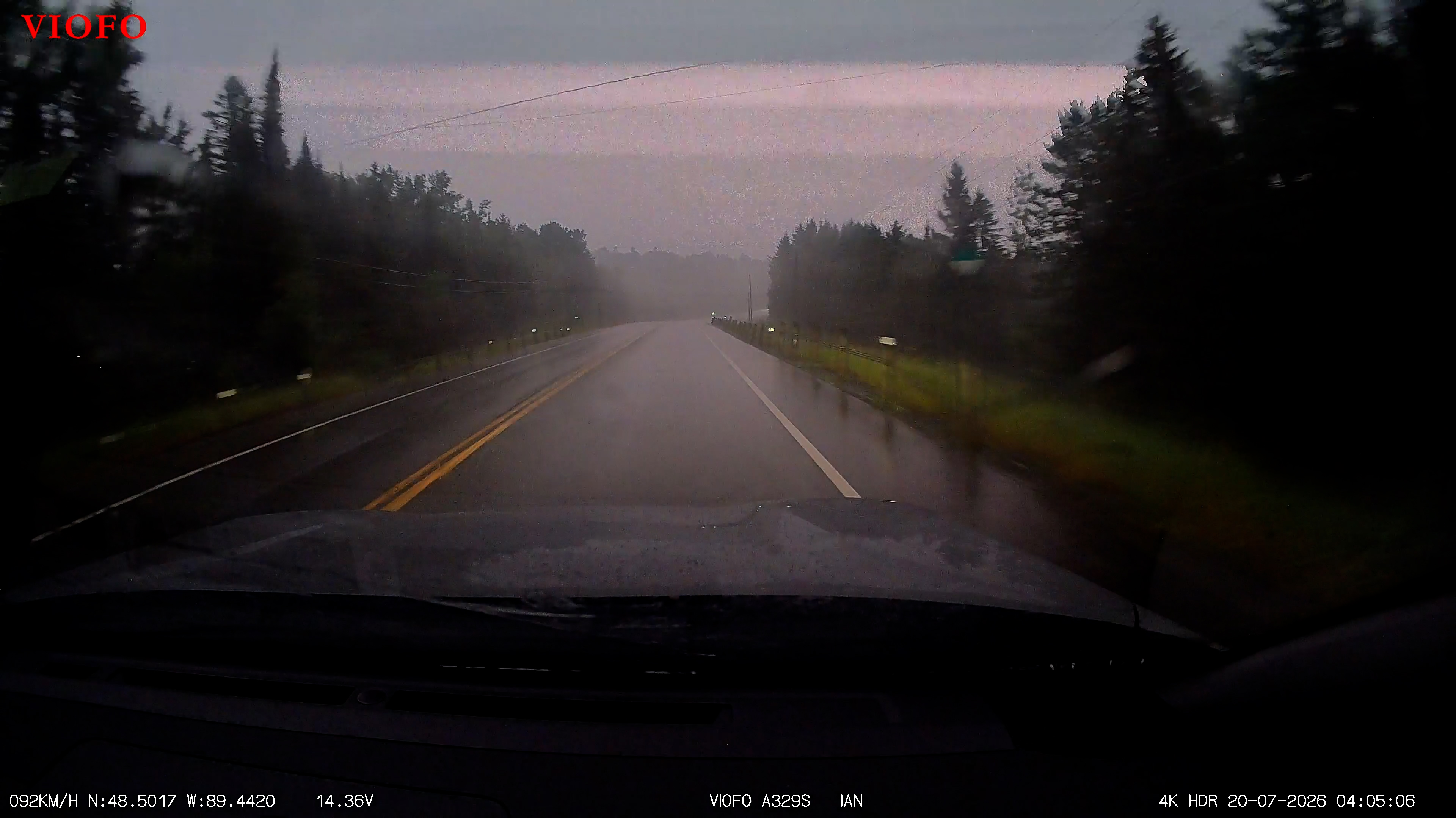
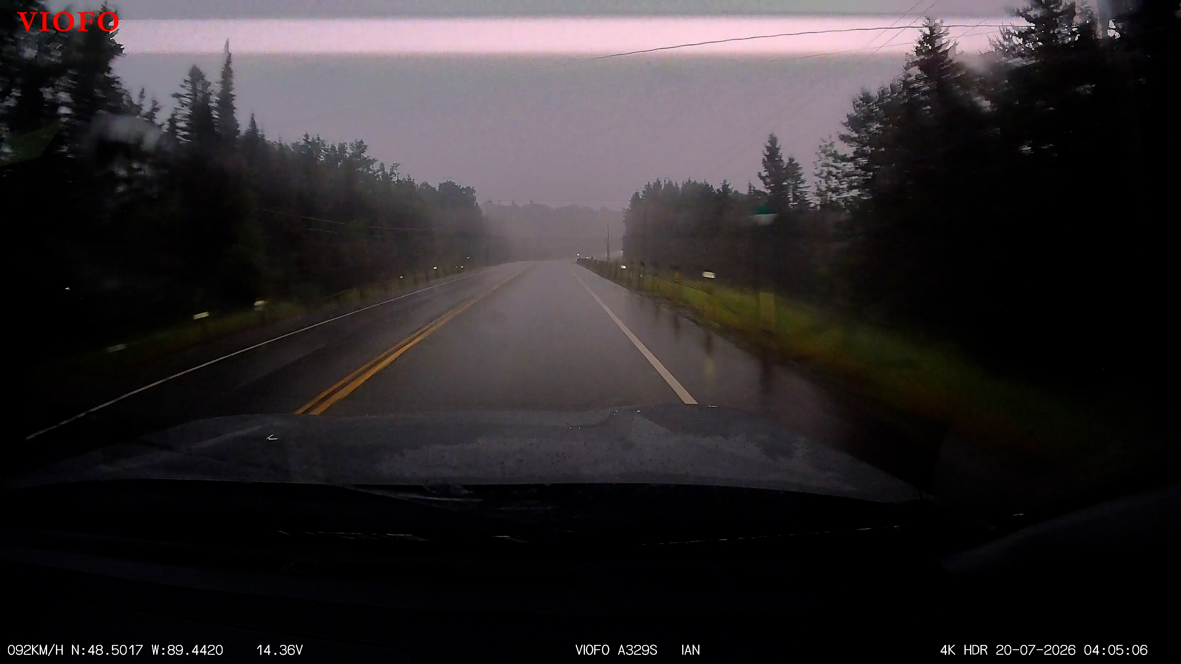
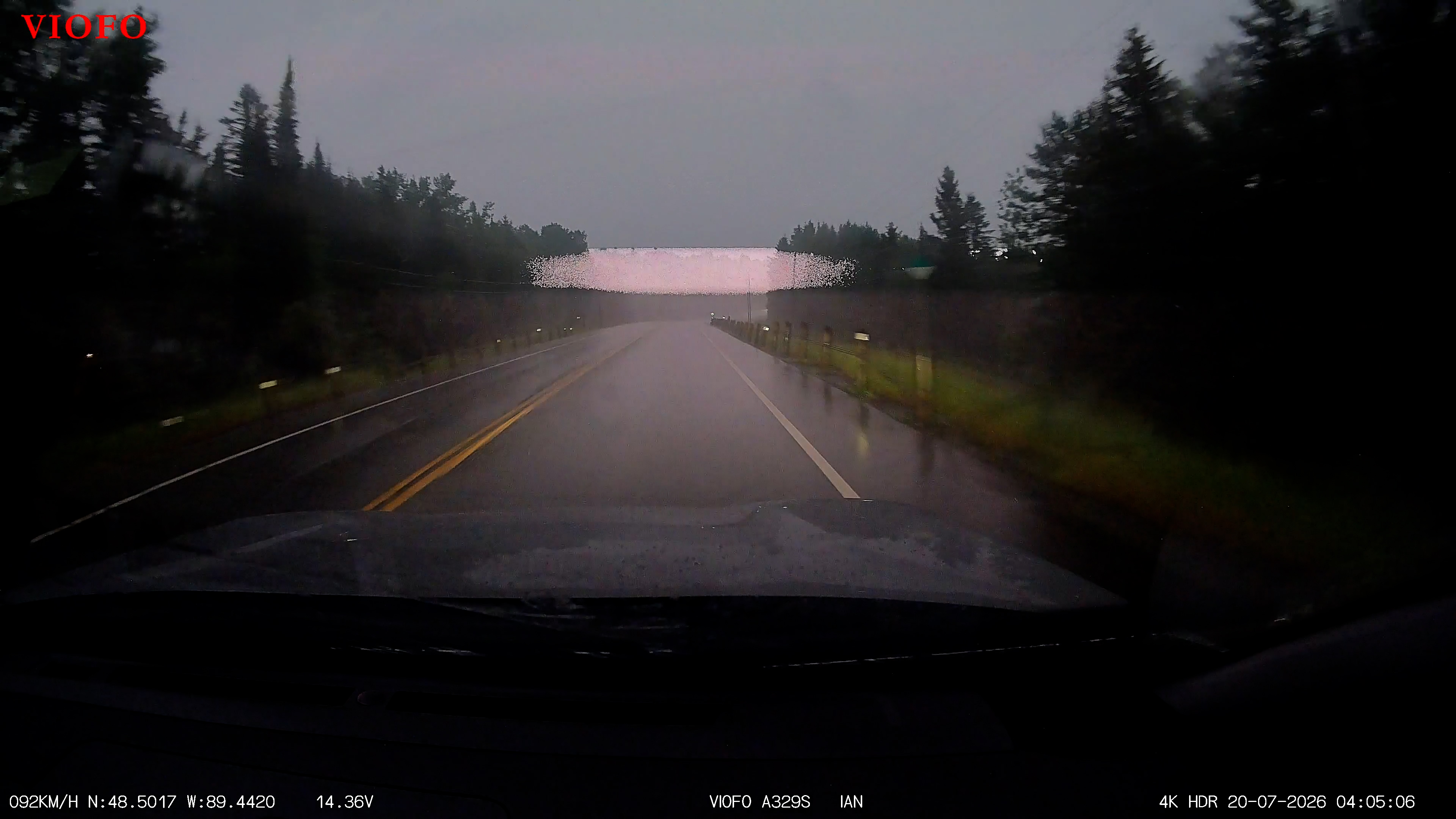
Look at the four images below. The first is a 9 second video clip from the dashcam. Start the cip and immediately go to full screen. At around 6 seconds you will see what looks like a flash of lightning. In fact, it's three flashes that occur in ~2 seconds, and the three images are the flashes extracted from the video. If you're wondering why it's not "forked" lightning, it's because this type of lightning, technically "intra-cloud lightning", occurs within a single cloud.
This went on for two hours and the strain of driving in these conditions gave me a serious headache. It was still dark at 08:15, long after the sun had officially risen at 05:25. The road was flooded in some places, especially at the sides, but it was impossible to see standing water in these conditions, so keeping my speed well down was essential to avoid aquaplaning and loss of control. Having said that, my Subaru has an extraordinary traction control system which can detect loss of steering and traction control and kick in to manage power, wheel rotation speed and braking as needed.
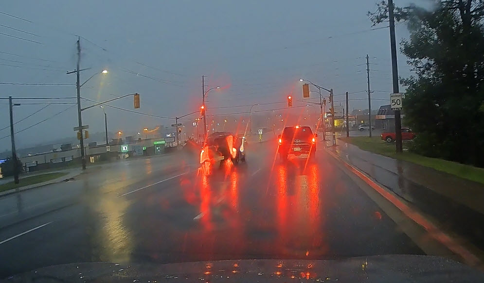
The constant rain, darkness meant absolute concentration on the road and traffic around me and this coupled with some very bright and flashing lights at times encouraged the headache gremlins to wake up and start their day!
Stopped for breakfast at about 09:00 thinking rain might ease off while I ate breakfast. This must have pissed off the weather Gods as it stopped as soon as I parked and resumed again just as I was getting back into my vehicle after breakfast!
There was more rain and lightning later but cleared up quite a bit towards lunchtime. I decided to skip lunch (I rarely had three meals a day on this journey) but had to stop to take care of another problem.
The dashcam fitted to my Subaru records 4k video at the front and 2k at the rear, which is a whole load of data. The dashcam manages storage by simply overwriting the oldest files with the new recordings, and during a long day that means some files from the previous day will be overwritten even when, as in my case, there is a 256 GB micro SD card in the camera. So, each night I had to transfer the previous day’s recordings off the micro SD card to a 5 TB SSD drive, and I had forgotten to do that last night.
I got down to the Northwest coast of Lake Superior. There are very few places to get gas and big warning signs to that effect at the start of this coast road. Equally, there are very few towns, but there did appear to be lots of places to take photos of Lake Superior, except that my superior decided today it would be shrouded in mist and rain; hopefully I can get some good shots on the way back (I did).
A couple of hours later I approached the Nipigon Bridge which drains Lake Nipigon (30th in the world by area) via the Nipigon River into Lake Superior, but this is no ordinary bridge! Fully completed in 2018, it is actually two cable stay bridges supported by three cable towers.
The middle cables appear to provide common interlocked support for one side of each bridge. Further, the two bridges are not the same length because the width of the gorge is different where they land. Here's a video clip of approaching and crossing the bridge.
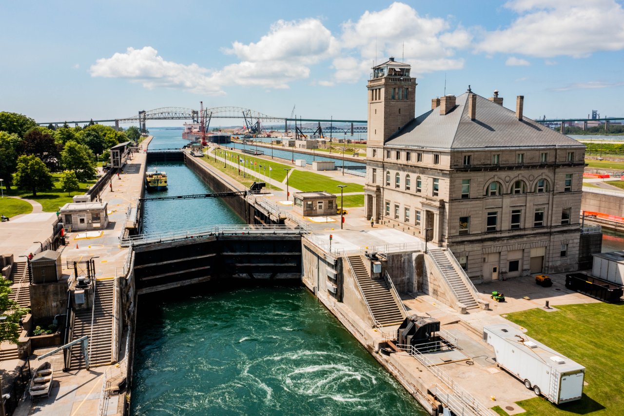
I was heading to Sault Ste. Marie, Ontario. The word “Sault” (pronounced "Soo") is an historic French term for “falls”, but in this sense that word means “rapids”, and not the traditional English interpretation of a waterfall. The Ste. Marie is simply the French name for the St. Marie river which drains Lake Superior into Lake Huron. To enable navigation from Lake Superior into Lake Huron ships pass through a series of locks to drop them down the 21 feet difference between the two lakes. The largest lock is 1,200' long and 110' wide.
About 80 miles from Sault Ste. Marie the storms and rain returned, just in time for rush hour and a crawl through the city. But at least this gave me a chance to see something of the city beyond the area around my hotel. I have stayed at many Holiday Inn Express hotels in the USA, and they all seem to have restaurants where not only is a free breakfast available, but dinner (paid) is also served. But the Holiday Inn Express I was staying at in Sault Ste. Marie had no facilities for dinner, though I found a good restaurant less than a 5 minute walk away.
That evening I decided to book the nights I had planned to be in Toronto, where I worked at 18 Yonge Street for a few months in 1981. I planned to take photos of that building and get the ferry to Center Island where I had enjoyed many nights of beer and softball. The prices for a hotel were extraordinary at over $500 per night – wave as I pass by Toronto!
I don’t have any travel planned for tomorrow except to see the houses my family lived in from 1921 – 1940 and to visit my father’s and grandfather’s graves for the first, and probably last, time in my life.
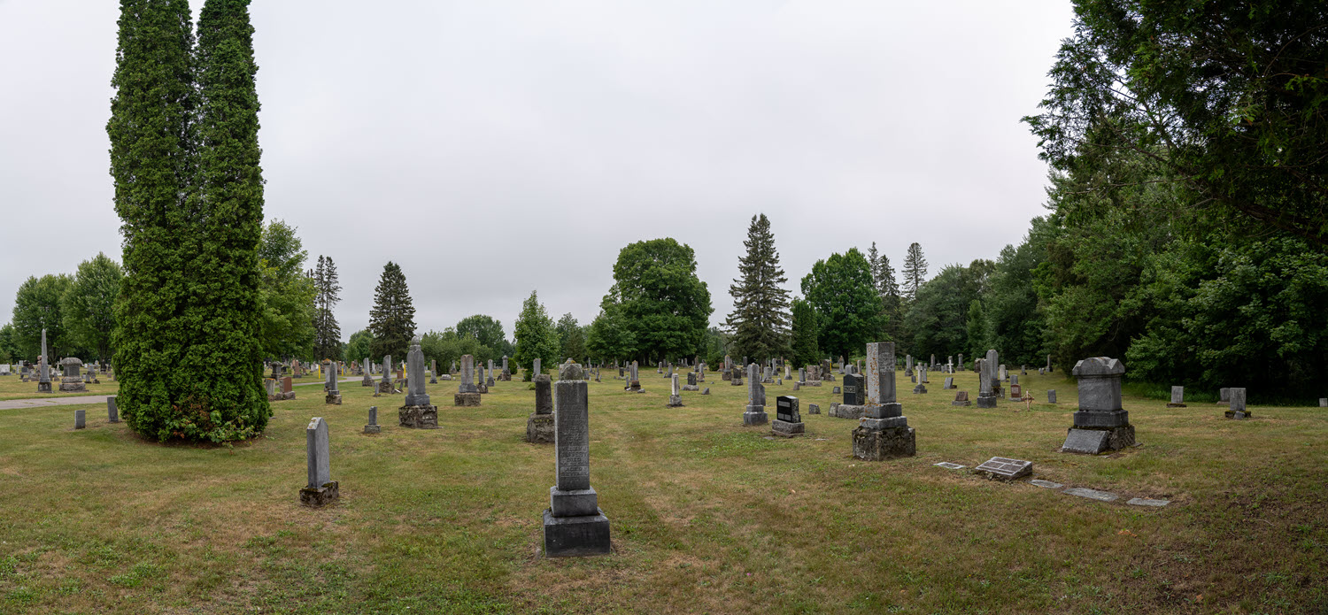
As this was a day of rest from driving, I got up later than usual, had a leisurely breakfast, then went to find my paternal family graves. My paternal grandfather had bought two adjacent graves in Greenwood Cemetery on the North border of town – seems I had driven past it on my way into town yesterday evening. This was very forward thinking on his part as he died just 5 days after being diagnosed with the Spanish flu on the 5th of November 1918 at the age of 36.
The cemetery office was very helpful, but it still took a while to figure out where Section 18 East was and where the graves maybe might be in that section. I couldn’t find them using the directions given by the office so eventually went back there, but they were closed for lunch. So, I walked the entire section in the rain looking for the graves and found them, though I nearly missed them because gravestones were dirty and partly covered with lichen. I cleaned them up as best I could using the hotel room key.
It was an extremely moving experience… the first, and, given my age, almost certainly the last, time I will visit these family graves.
According to his birth certificate, dad was born in Wellington Street in Sault Saint Marie, but the house number is not shown on the certificate. Fortunately, the 1911 census also shows him and the family at 127 Wellington Street. Unfortunately, it no longer exists!
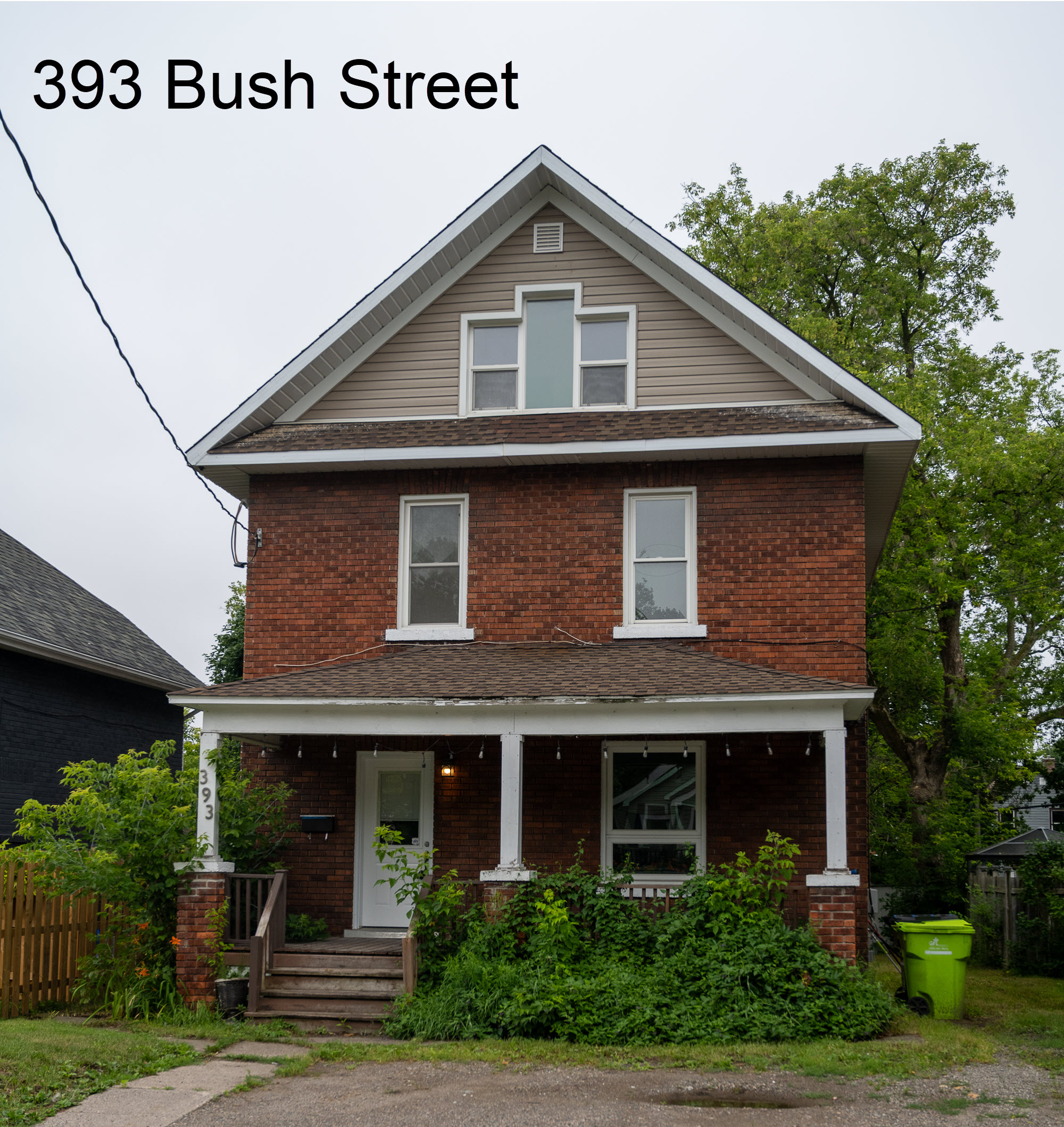
Next it was off to see 393 Bush Street where dad lived in 1921, 393 Bush street where dad lived with his two younger sisters, mother and stepfather, James Easter, in 1931. My grandmother had married James Easter in December 1926, and he joined the family in her house in Bush Street.
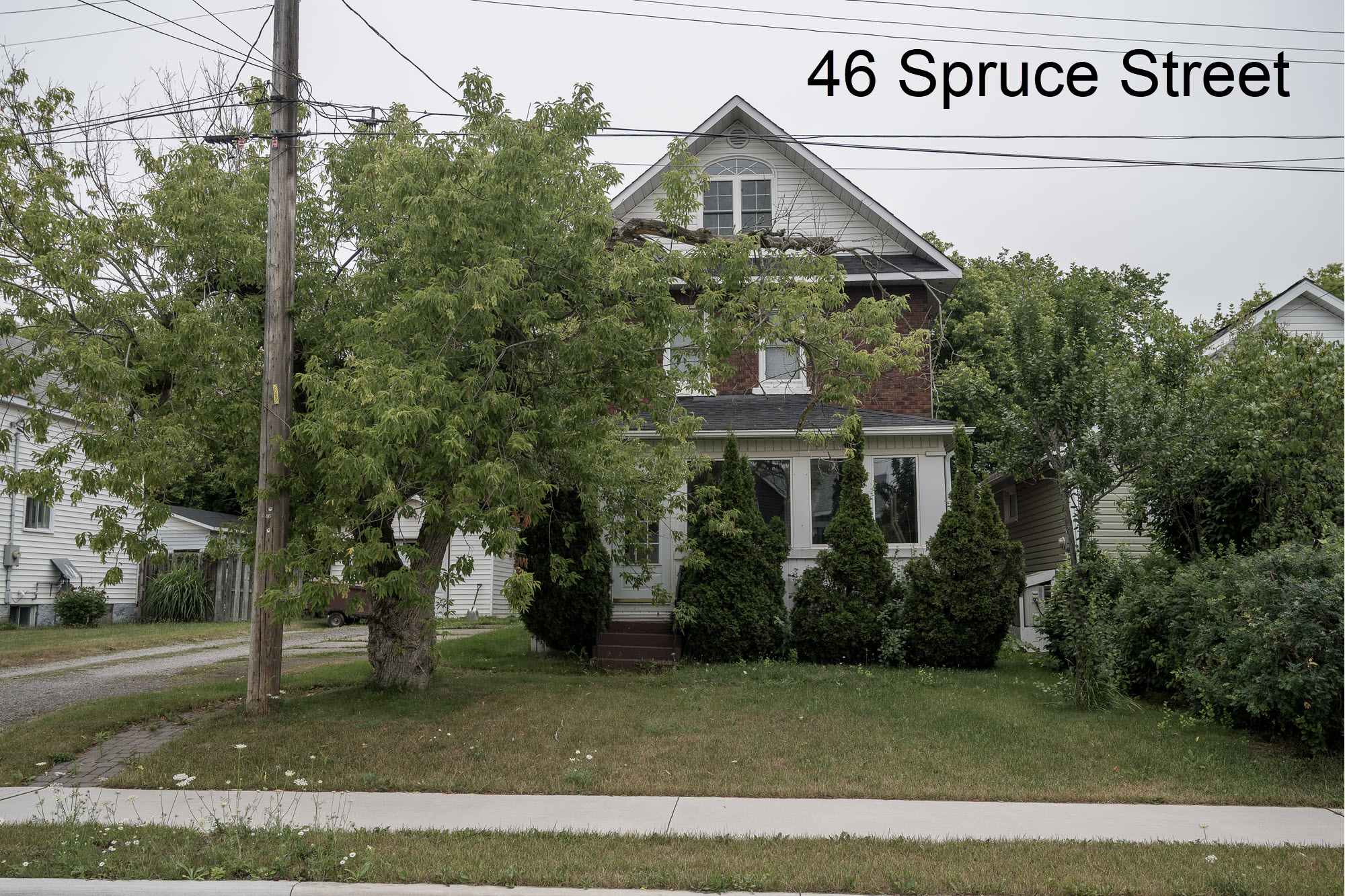
By 1940 dad, his first wife, his mother and stepfather were all living at 46 Spruce Street, Sault Ste. Marie.
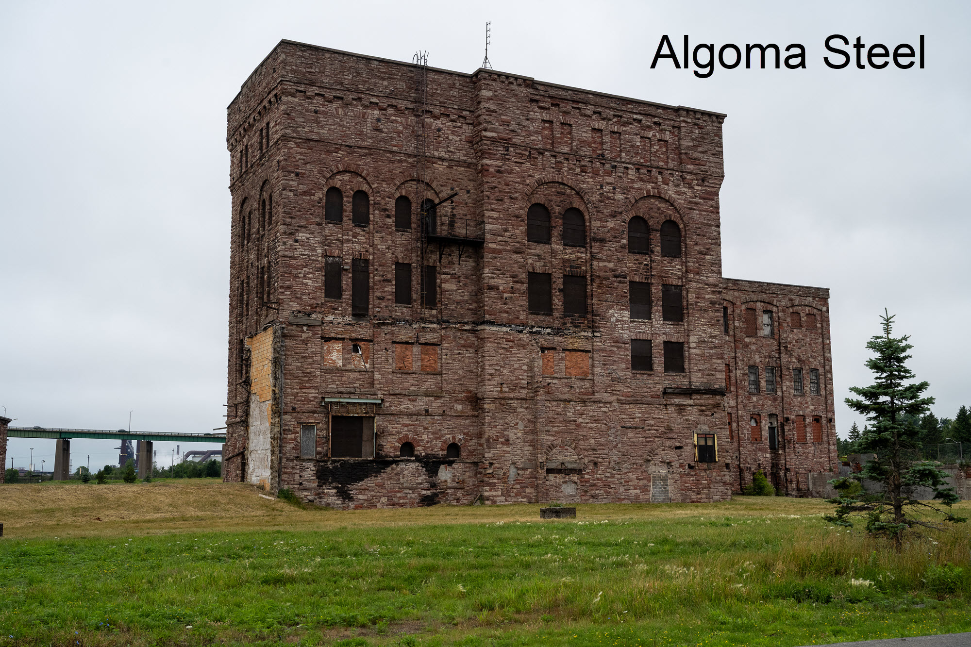
Sault Ste. Marie has been a steel town since 1903 and just like him, many of dad’s relatives also worked at what is now the Algoma Steelworks. Ontario is a source of iron ore (though not as much as Quebec and Newfoundland), Sault Ste. Marie is on the Saint Marie river, part of the Great Lakes marine transit system, and it’s the site of a major rail freight terminus. What it doesn’t have locally is a source of coal, but of course with access to rail and the Great Lakes, coal could be shipped in by rail from Alberta and Saskatchewan or from the USA via the Great Lakes.
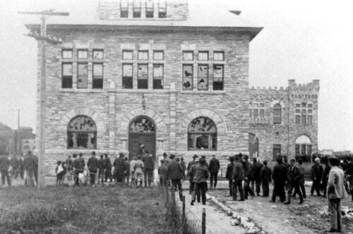
After grabbing a Subway sandwich for an early dinner, I walked around the area where the original head office was for Essar Steel Algoma – the original name for what is now Algoma Steel Inc. (Sault Ste. Marie is the seat of Algoma District). The main steel making plant and rail yard is just to the North of this. You can see the similarities between the surviving buildings and the original head office in 1903.
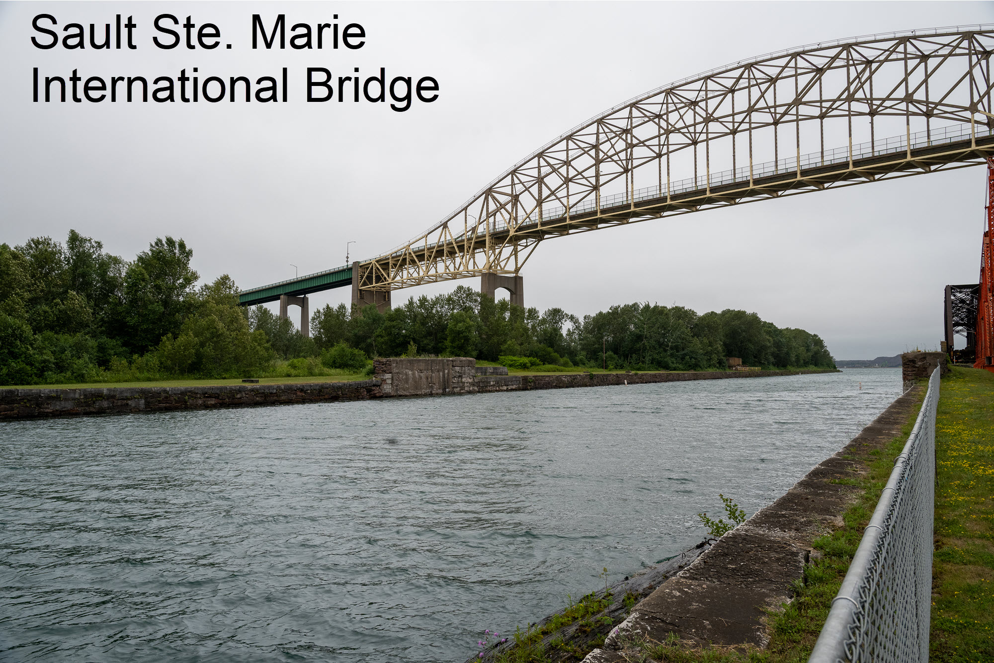
I also walked a short way down the Sault Ste. Marie Canal and got a grand view of the Sault Ste. Marie International Bridge that links Sault Ste. Marie in Ontario with its sister, Sault Ste. Marie in Michigan.
It’s been an emotional but interesting stopover in Sault Ste. Marie.
I got up later again as there was only 306 miles to drive today from Sault Ste. Marie to Mattawa, also still in Ontario. Lake Superior may not be named as a sea, that’s effectively what it is, so seagulls abound, and while I dreamt sweet dreams they had left little presents for me all over the Outback! I had to clean these “presents” off the car before setting off as they attack car paint rapidly, and even though the car has a “special” coating on it that garage attempted to make me pay $700 for, I didn’t want to take any chances.
There was better weather for most of the day though it started raining again as I got within 10 miles of leaving the hotel, but then the skies cleared and remained that way until an hour or so before I reached Mattawa.
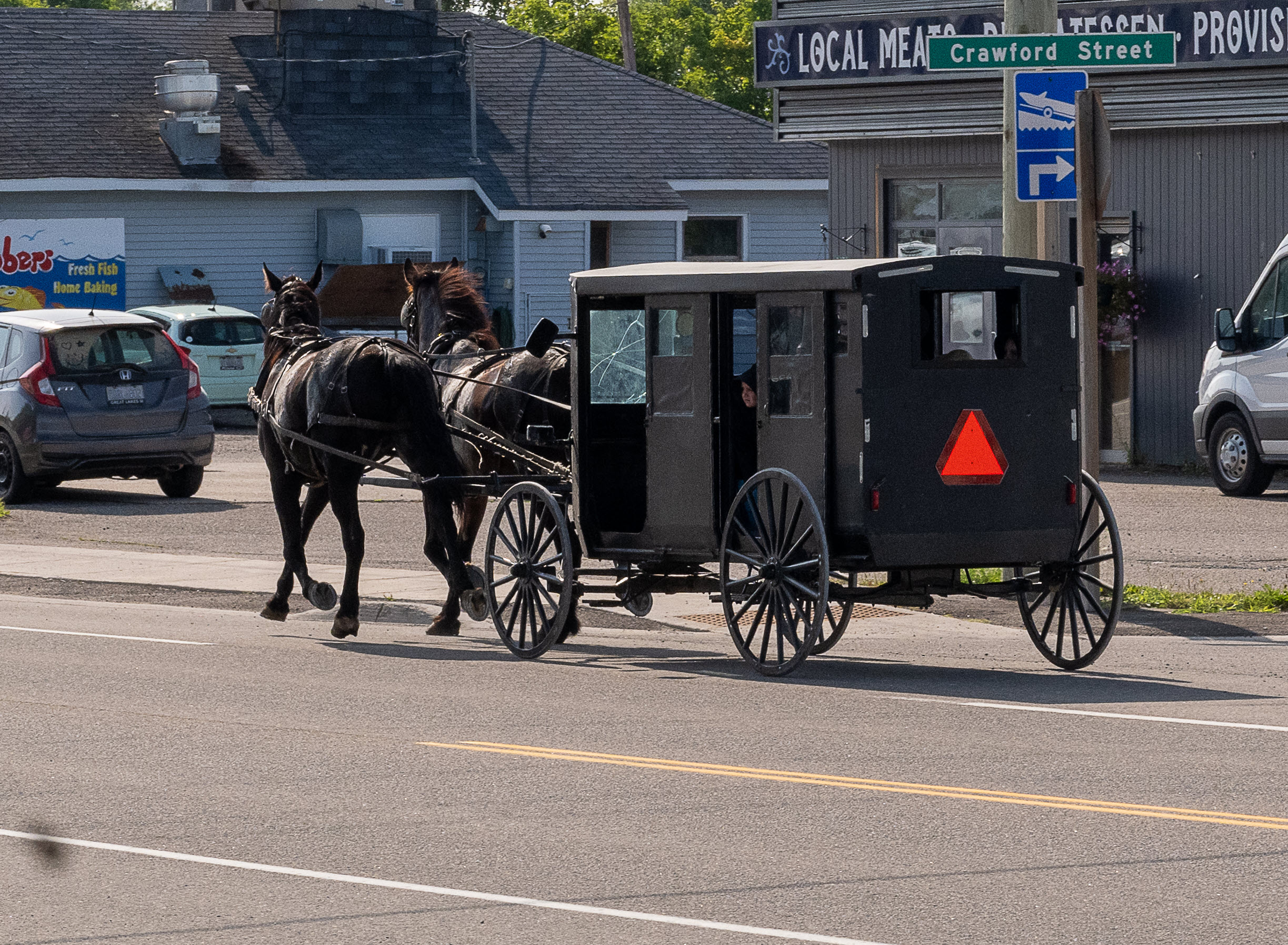
About 40 miles East of Sault Ste. Marie, I stopped in the town of Desbarats to gas up. As I stood by the pump patiently waiting for the tank to fill, I could hear the distinctive sound of a horse with shod hooves rapidly approaching the gas station from the direction I had just come from. I instinctively stopped pumping gas and ran around the Subie to get to the passenger door and yank it open. Before I set off, I try to make sure that my Nikon has a full battery, is set to Auto and is easily accessible in the top of my backpack, and I had done so this morning.
I grabbed the Nikon and just had time to get a couple of shots of the old horse and buggy that had gone by me at quite some speed. There is a Mennonite community in the North side of Desbarats, and they sell produce and provide services from their shop there, but you won't find it on the web because their way of life, which one must respect, harks back to much earlier times.
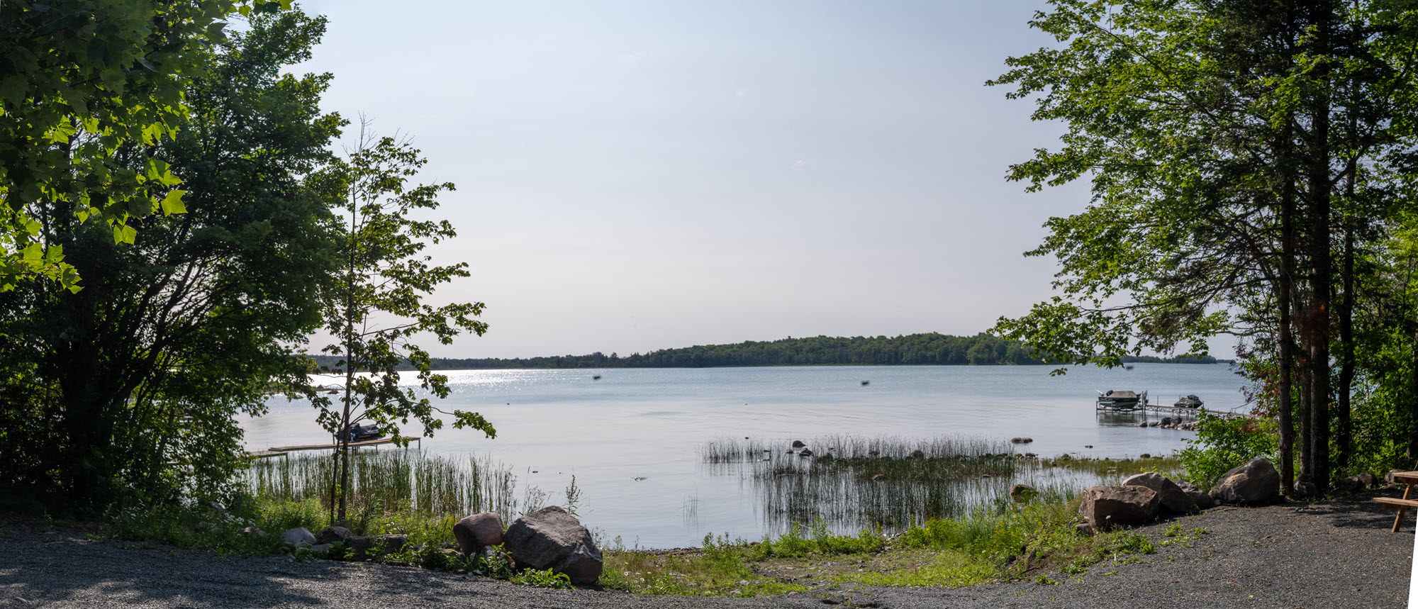
A couple of hours out form Desbarats I was following the Northern shore of Lake Huron and kept looking for a posted lookout/photography spot like the ones on the shore of Lake Superior. I hadn’t been able to use those because of the mist drifting in from off the lake. I didn’t see any spots posted, so after a while I decided to head off down some of the smaller side roads that left Highway 17 in the direction of the lake. I hit a few dead ends but then saw a sign, not to a lookout/photography spot, but to a Provincial Park called Waltonen Park. I followed what was really just a dirt track for about half a mile and was rewarded with a wonderful view over Joe Dollar Bay on Lake Huron (nope, I didn’t make that name up!). The panorama is above and there are more photos and a video of the approach in today’s media.
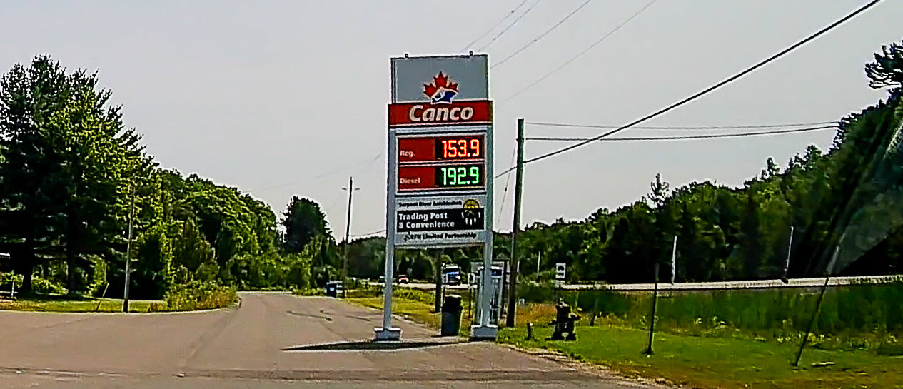
The terrain was reasonably flat with gentle rolling hills, and lots of trees. Around 11:15 I pulled into a small indigenous Maamwesying trading post a few kms past the Serpent River settlement. The coffee was excellent, but the icing on the cake was gas at $153.9 per litre, compared with >$2 back home. Normally, part of the difference would be that this trading post is on Maamwesying tribal land so, just like in the USA, it’s exempt from collecting the Federal tax of 10 cents / litre on gas. But since the Federal gas tax is suspended from April 20 to September 10, that makes the difference even larger.
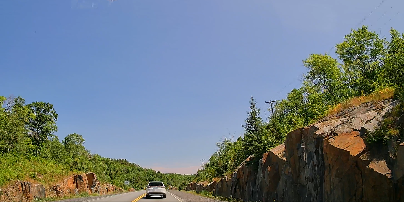
After lunch there was a noticeable increase in the roadside rock formations and there seemed to be an infinite variation on type, shape and colour. I was surprised by this so later did some research to see why this variation is there. It seems that much of Ontario is covered by the Canadian Shield, which is made up of many different rock types.
The afternoon was uneventful other than visiting Best Buy in Sudbury to replace a USB C, with music on it, which I had lost. The Outback has both USB A and C ports, but the A port can only be used for power, not reading devices.
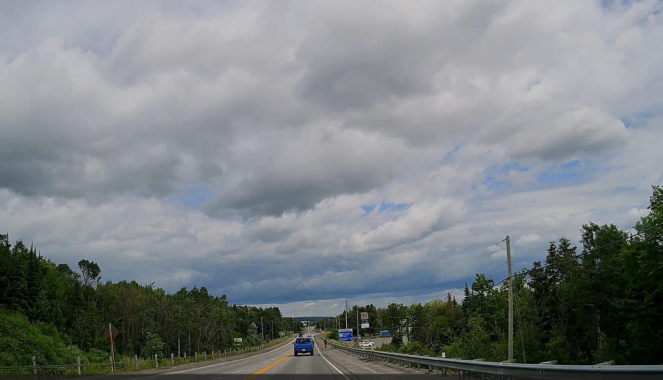
By mid afternoon the blue skies had disappeared under a blanket of curly cumuli nimbus thunder clouds.
I reached Mattawa about 4 pm and found the hotel reception desk empty. I stayed in a hotel called Le Voyageur but despite its French name its run by a Thai family When I finally checked in, I found the hotel room was very small and the hotel in general very tired, but it has a decent Thai restaurant and I think that’s what the family is really focussed on. For dinner I ordered up a noodle dish, and the waiter asked me how spicy I wanted it 1-5. I said let’s try a 10 and off he went. It was a little warm but not really hot for me, but as the waitress cleared my plate away this woman walks up and asks me if I finished the 10 noodles, and I told her that I had. She looked at me in disbelief and said she and her mother had struggled to finish the same dish at 5, even though she had been raised in Trinidad & Tobago on spicy food. I had to explain my MC1R mutation, one effect of which is a high tolerance for spicy food.
The window blind in my room was battery operated by a button on a hanging rod, so I held the rod to close the blind and it came away in my hand. I went to inform the hotel and was then told that there would be no power in the main building tomorrow between 0900 – 1300, so I asked to be moved into the annex and was flatly refused.
I think I’ll give this place a miss on the way back!
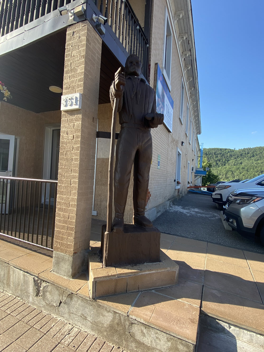
Another morning with no need to get up at the crack of dawn – what a luxury! I did email for a while and then went down for breakfast which consisted of bread/toast/orange juice/coffee – and not much else. Then it was back up to my room to continue working on my laptop until the scheduled power outage at 0900. The battery on my laptop only lasted until 1100, so it was off to Tim Hortons just down the road for tea a cup of tea and power for my laptop. But first, I had to sneak past that wooden giant guarding the hotel entrance.
I went back to the hotel at 1330, long after the power was due to be restored at 1300, only to discover that there was still no power. I found the owner in the restaurant and asked what work required such a long shut down, I was told that the standby generator had to be serviced. How interesting….. we built a house in Texas, and given the frequency with which tropical storms, tornadoes and hurricanes triggered power outages, we had a mains gas fueled standby generator installed.
By their very nature, cutover standby generators are disconnected from the main circuits until they detect a power failure. Which means that they can be serviced without cutting off power to the property. Further, they don’t take 5 hours to “service”. At that moment the electrician come marching into the restaurant, so I asked him why it was taking nearly six hours to simply service a standby generator. He said, “I’m busy” and rushed out of the room.
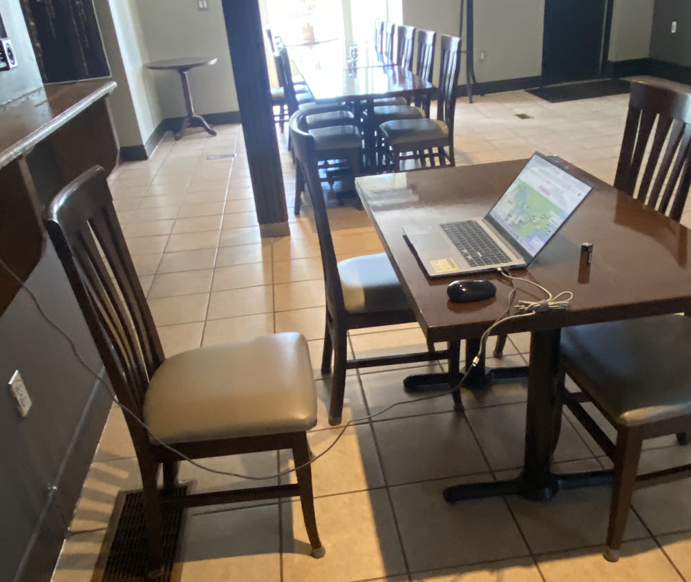
The next thing I knew, the power came on in the restaurant. When I gave a sigh of relief, I was promptly told that power was being restored only to the restaurant. Good, I replied, I will sit here at this table and work on my laptop while you get me some coffee. Protests followed that they were busy, had no coffee and couldn’t fire up the expresso machine.
You have a choice…. I am going to sit here and work and you are going to get me a cup of coffee; or I shall make a claim on my credit card because you charged me card to provide me with a “working” room for 2 days and you have failed to do so. I was instantly invited to sit at the table I was already dumping my equipment on and a waiter was ordered to go get my coffee!
I had originally planned to stay in Grenville Argenteuil the next night, but finding a suitable hotel turned out to be not so easy.
I specifically wanted to stay there because it where my great-great-grandfather arrived from Old Machar, Aberdeen in Scotland, and two generations after him were born. I managed to book a hotel in Rigaud, Quebec, about 20 miles further into the Province of Quebec.
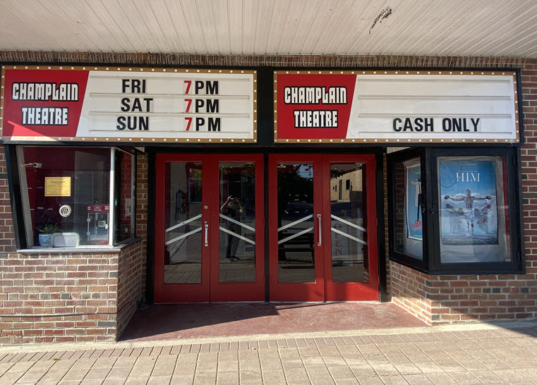
I decided to have dinner at a Chinese restaurant a short walk up the road from the hotel. On the way to the restaurant, I passed a classic cinema which appeared to be in pristine condition but didn’t seem to be still showing movies.
Still, everything started at 7 pm, so if I had a quick dinner, I could make the start of the movies that weren’t showing!
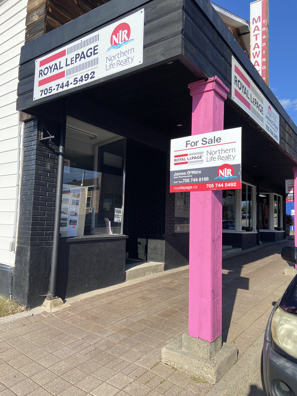
And then there was the realtor (real estate agent) that was advertising a property for sale. Realtors are always chuffed when they complete a sale, but in this case I think they will be over the moon if they pull it off. After all, it’s not often you see a realtor selling itself…. The building for sale was the one that they occupied.
I think I am looking forward to getting out of town tomorrow….
Got up late this morning around 7 am as I don’t have far to drive today, just 264 miles. I was originally going to stay for a couple of days in Grenville QC to see the farmland my ancestors worked when they first arrived from Scotland, but I couldn’t find suitable accommodation, so booked a hotel in Rigauld QC instead.
Mattawa would have been a natural place for a settlement as it’s where the Mattawa River flows into the much larger Ottawa River, which in turn flows into the St. Lawrence River at Monreal some 300 miles further East.
Since I was still in Ontario, that meant I was still on Highway 17 as part of the Trans Canada Highway, and this road more or less follows the Ottawa River into the Province of Quebec just before Rigaud, where I will stop for the night. But ever since Mattawa, had I crossed to the North bank of the Ottawa River, I would have been in Quebec.
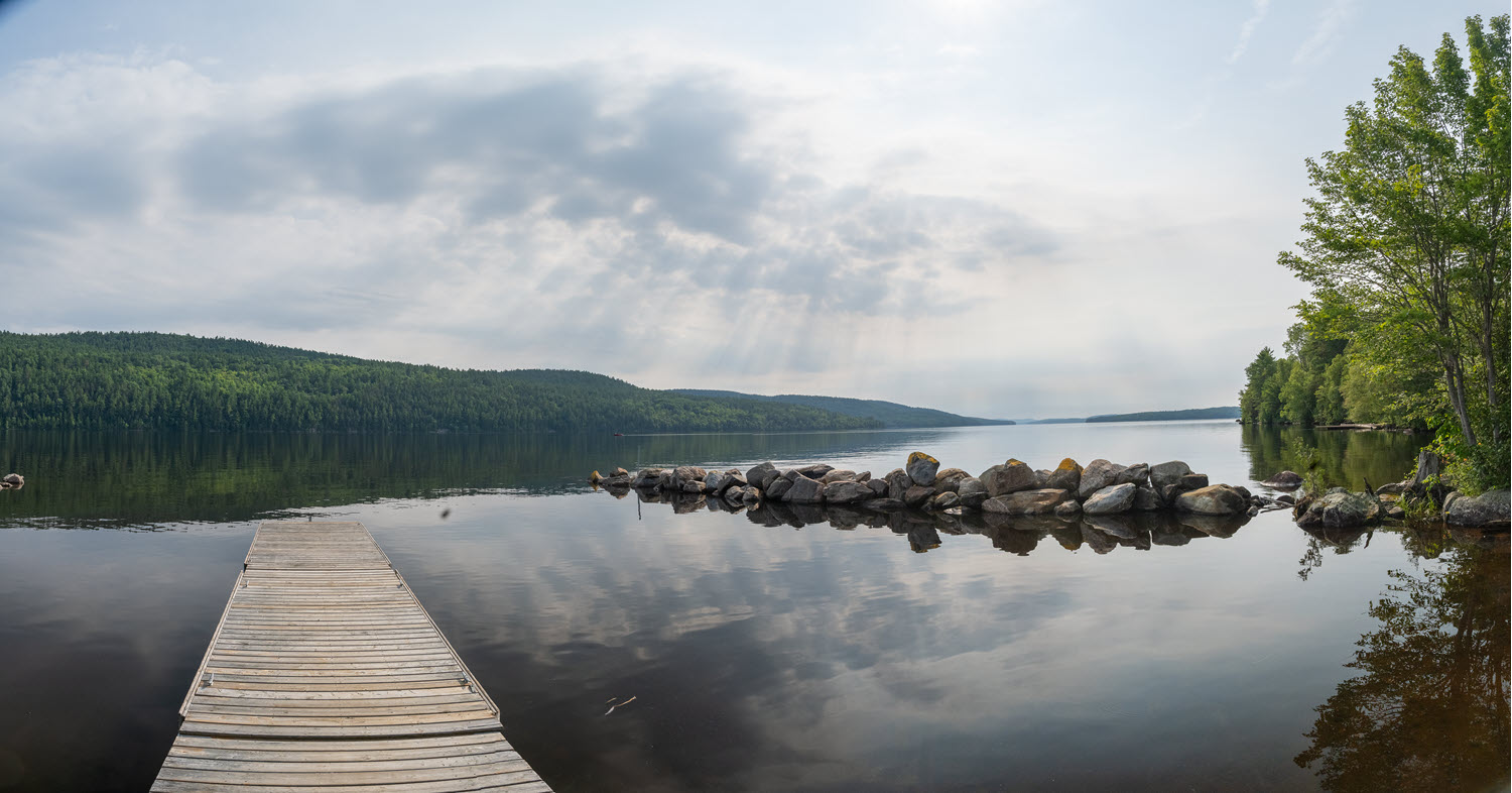
About 40 miles East of Mattawa, I stopped at a gas station which appeared to be very close to a very pretty lake. I saw a sign to a boat ramp so decided to explore it to see if I could get some nature shots with my Nikon.
At the boat ramp I discovered I was in the small settlement of Head, Clara and Maria…. no… I didn’t make that name up, strange as it is, it’s on a sign at the ramp and shows up on Google maps too! The photos are in the media for today.
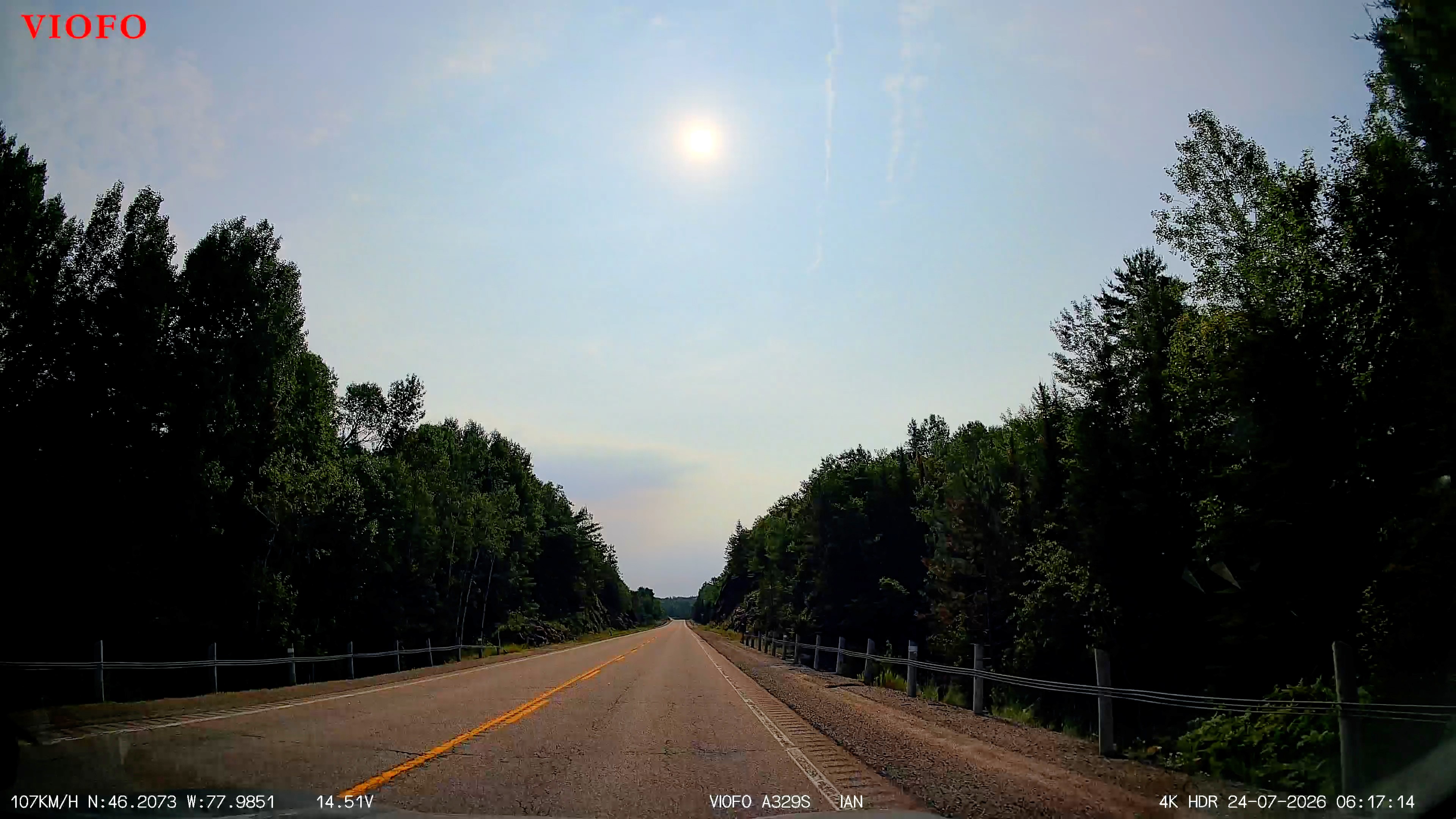
The road was single lane each way for most of the way, with boreal forest on either side. Most of Canada’s boreal forest is above the 50th parallel but there are patches of it here in Southern Ontario at 46 degrees. PHOTO
By 1 pm I was into the Southern suburbs of Ottawa, the capital of Canada. It’s not a very large city and sits only on the South side of the Ottawa River as the river is the boundary between the provinces of Ontario and Quebec. By now the roads were at least two lanes each way, increasing as I approached the Southern end of the city center. Although it was a Friday, traffic was light. The sky was blue with occasional wisps of cloud – a perfect day for driving.
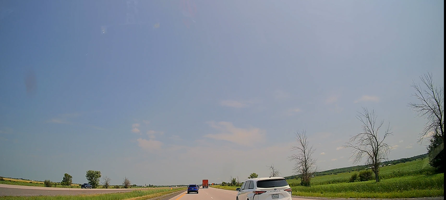
The land to the Southeast of Ottawa is an alluvial plain between the River Ottawa and the St. Lawrence River, very fertile from centuries of silt deposits and perfect for farming. The land had flattened out and most of the trees were gone as I drove across this plain. PHOTO
Everything is in French now and the road signs are very different from other provinces, with considerable use of yellow & orange signs (get still from video). British Columbia has frequent distance signs but there seemed to be less in the other provinces, until I got to Quebec which has them in abundance.
Most of the road today has been two lane highway and although I am still on Trans Canada Highway, in QC the road is numbered 40 West of Quebec city and 20 to the East.
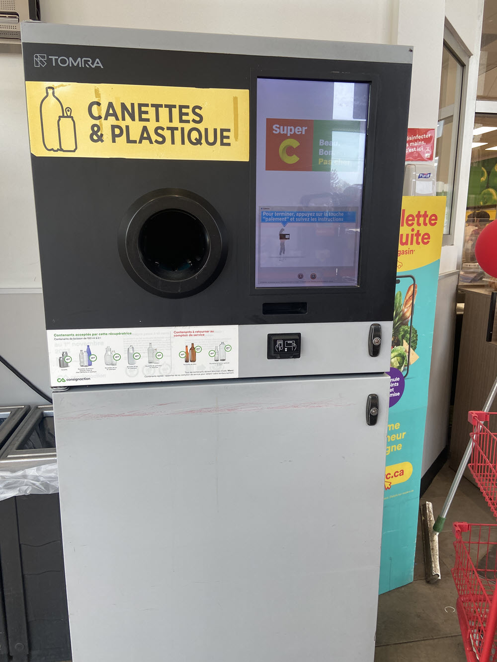
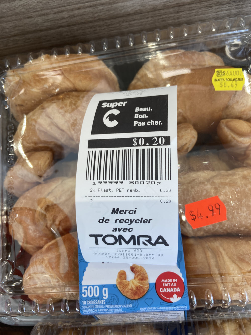
Finally, I popped down to the Rigaud local supermarket just down the road from the hotel to get some food for a light dinner. Of course, everything was labelled in French, so it was as if I had been ported 35 years back in time and I was shopping in my local Geant supermarket in St. Genis-Pouilly, but with the disadvantage of not having shopped in French on a regular basis for decades!
But the other thing that was clearly different was the method for returning bottles and cans. In 1991 in France, it was simple – you didn’t! But in 2026 you can do it by just dropping your returns into a machine, telling it when you had finished, taking the coupon that was printed for the value of your returns and presenting it to the cashier when you checked out. No need to scan anything, no need for a cash transaction or giving change and very, very fast.
I got up late (7:30) as it’s another non driving day. I did some washing, had a shower, lazed a little and did a lot of email and blog. I also spent a lot of time processing photos from the Nikon and video from the dashcam.
I managed to get good rate for tomorrow night at the Holiday Inn Express in the South of Quebec city; and for 2 nights in St. John New Brunswick, where I go on 27th.
Today wasn’t the most exciting day on earth, but it was spent catching up on some essentials.
You may have noticed by now that I haven’t once stayed overnight in my car as I had planned. Doing so, it turns out, is a really bad idea when going across Canada in July. Apart from a couple of days of torrential rain, it has been HOT! If you do sleep in the car, you can’t leave a window even slightly open as every insect on the planet will stop by to say hello and never leave and there’s no air conditioning unless you leave the engine running all night which is a terrible idea, not to mention a very costly waste of gas.
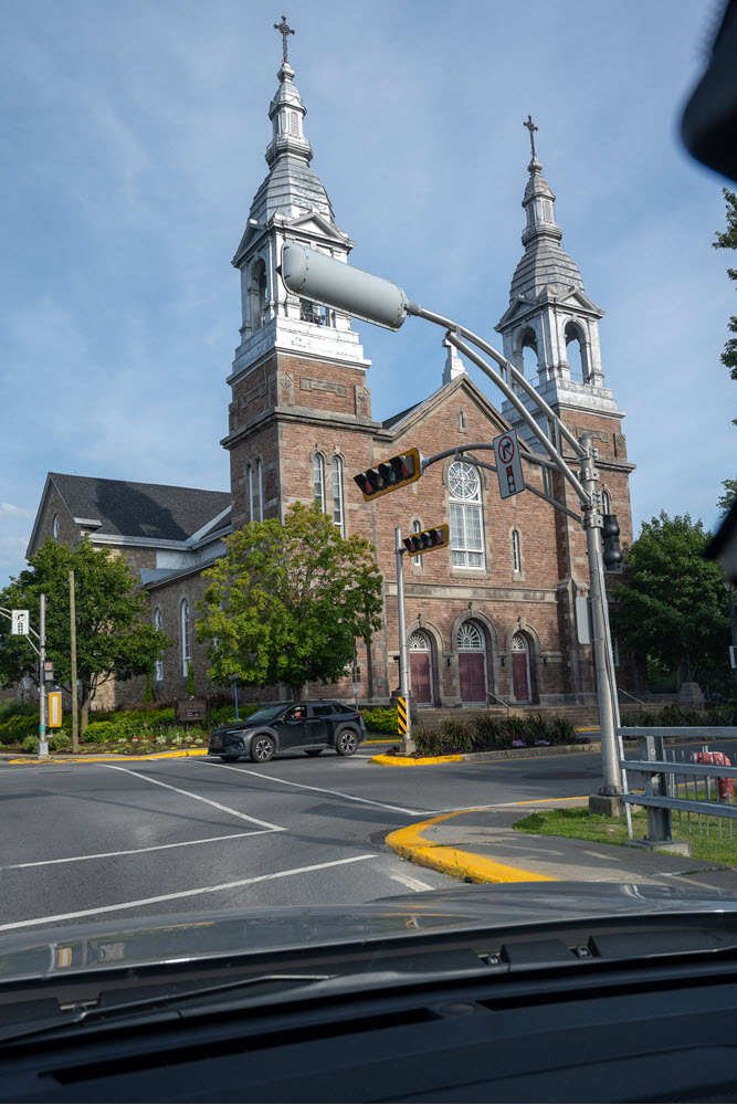
I shopped at a local supermarket in Rigaud for dinner and on the way passed a beautiful church just as I entered the center of town. – photo Nikon.
A peaceful end to a very quiet day.
I got up relatively late again as I only have 228 miles to drive today. As I left the hotel in Rigaut the sky was becoming cloudy, and in the distance the morning sky was a bright reddish orange. As the proverbial shepherd’s warning goes…. red sky at night, shepherd’s delight; red sky in the morning, shepherd’s warning. It definitely looked as though it might rain today.
On this trip there were quite a few roadworks (construction), but in Quebec there has been a very large number of roadworks. Unlike Lower BC, it’s very difficult to repair and maintain roads in the winter due to the cold and the snow – you can’t repair a road you can’t see!
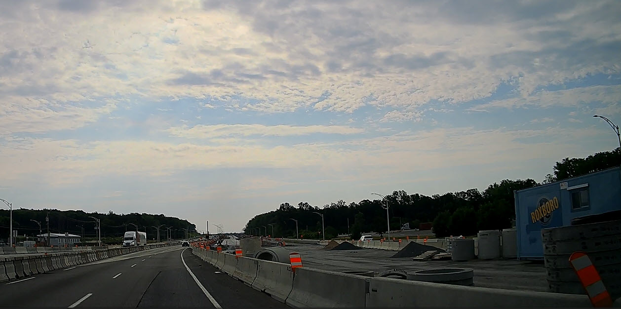
As I drove through the province of Quebec today, I was puzzled by the huge number of roadworks where the cones were to the side of the road, and no one was working on the site. This was particularly noticeable as I drove through Montreal. Then I had a brain fart and realised why this was the case…. Today is Sunday! Of course, I’d like to claim this was all good planning on my part, but……
I followed Highway QC 40 on through Montreal towards Trois-Rivières staying on the North side of the St. Lawrence river, but I noticed later on a map that another road with the Trans Canada icon but with no number, left Montreal to the South and continued up Northeast following the South bank of the river.
Montreal seemed to be festooned with junctions and road signs, so perhaps I simply missed a turning and continued on QC 40. In the end it didn't make any difference because both highways end up in Quebec City. Although I had been to Montreal before, they were always short trips where I had flown in, so I had never got to see much of the city, so I was surprised to see that much of the city is on an island in the middle of the St. Lawrence river.
As I left Montreal behind me the land became flat and heavily farmed – I was on the alluvial plain on the north bank of the St. Lawrence River. This wasn’t quite like being back on the Prairies, but it did at least mean that the were few hills around.
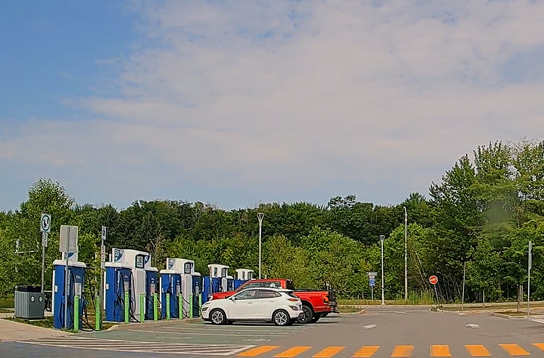
I stopped at a rest stop which consisted of just a hall and a few vending machines, but at least I could get a coffee and stand around for a while. When I went back out to get into my car I noticed this row of EV charging stations. There are more and more popping up all over the place. I got back on to the divided highway – a nice change from most of Ontario.
I have also noticed flashing green traffic lights and wondered what the protocol was. There are also flashing green traffic lights in BC, and they mean that the lights stay green in your direction but can be made to change by a pedestrian waiting to cross. Same in Quebec? Of course not, two provinces in synch on something as important as green traffic lights? Don’t be silly! In Quebec that flashing green light means you have priority over oncoming traffic if you want to turn left. Every other province I’ve driven in uses filter green lights for this purpose, but in Quebec…….
Despite the ominous signs first thing this morning, the weather remained quite good except for a few spots of rain from brief showers on the way.
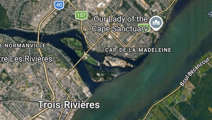
Soon, I was passing through the city of Trois-Rivières (Three Rivers). Now, if there was ever a global award for the most misleading city name, then the city of Trois-Rivières would easily win it outright. Why? Well, there are actually four rivers in the immediate vicinity of the city, but only two that I could find names for – the great big St. Lawrence river, and the Saint Maurice river that runs into the St. Lawrence. So, it’s not four rivers, but it’s not two either? No, actually it’s just one – the Saint Maurice that flows into the St, Lawrence. But just before it enters the St. Lawrence it splits into three channels, so this area has been known as the Trois-Rivières since the 17th century, and the city is named after it. Obvious really, isn’t it!
The land continued to be flat all the way to Quebec City as I was following the North (Left) bank of the St. Lawrence river and still on it alluvial plain. Add that I was on a divided highway and progress was quick.
When I got into Quebec, I wanted to pick something up at Best Buy – just 4 minutes from the hotel. But the road Best Buy was on was being dug up so I was advised to go in the back way. Over the next 30 minutes I went the back way, the front way, side way, any way and even did it my way, but still, I couldn’t find a way into Best Buy. In desperation I parked outside the main mall and went in to see where Best Buy was. I walked 50 meters and saw the entrance to Walmart and wondered if they had what I wanted – they did!
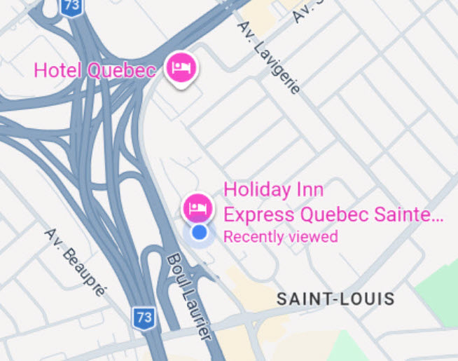
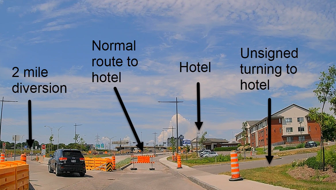
I stayed at the Holiday Inn Express in Quebec City South. It is 5 minutes North over the St. Lawrence river from the Trans-Canada Highway, or rather, it should be. Today it was more like 35 minutes because there were roadworks on virtually the entire area of the largest junction in Quebec city; where five major roads meet. The hotel would normally be approached from 175 North, but that road is closed. If you’d like a tour of the five road magic roundabout get in touch because I know the bloody thing quite well now.
For dinner I researched restaurants within walking distance of the hotel. Almost all were way over what I wanted to spend, only the Pizzeria was reasonably priced…. But of course, being Sunday, it was closed! MacDonalds to the rescue.
I left at 0630 anticipating possible heavy traffic to leave the city, but the traffic was quite light. To get from the hotel back on to the main road I had to cross two car parks, head South and then West to come up to the hotel again to bear left before getting as far as the hotel. I was quite familiar with this particular route, having gone round it three times yesterday, trying to get to the hotel!
That heavy traffic that I had anticipated never materialised. There was not much traffic at all heading North into the city over the Pont Quebec, and even less heading South like me to leave the city. Yet it was a Monday, not a weekend, and not a public holiday either. Perhaps the Traffic Gods were on my side today!
The video of my departure from Quebec City is just over four minutes long, much longer than other videos in this blog, but it’s worth watching to see all of the roadworks, last minute signs and multiple turns needed just to get on to the old Pont Quebec (Quebec Bridge) to cross the St. Lawrence river and head East towards New Brunswick.
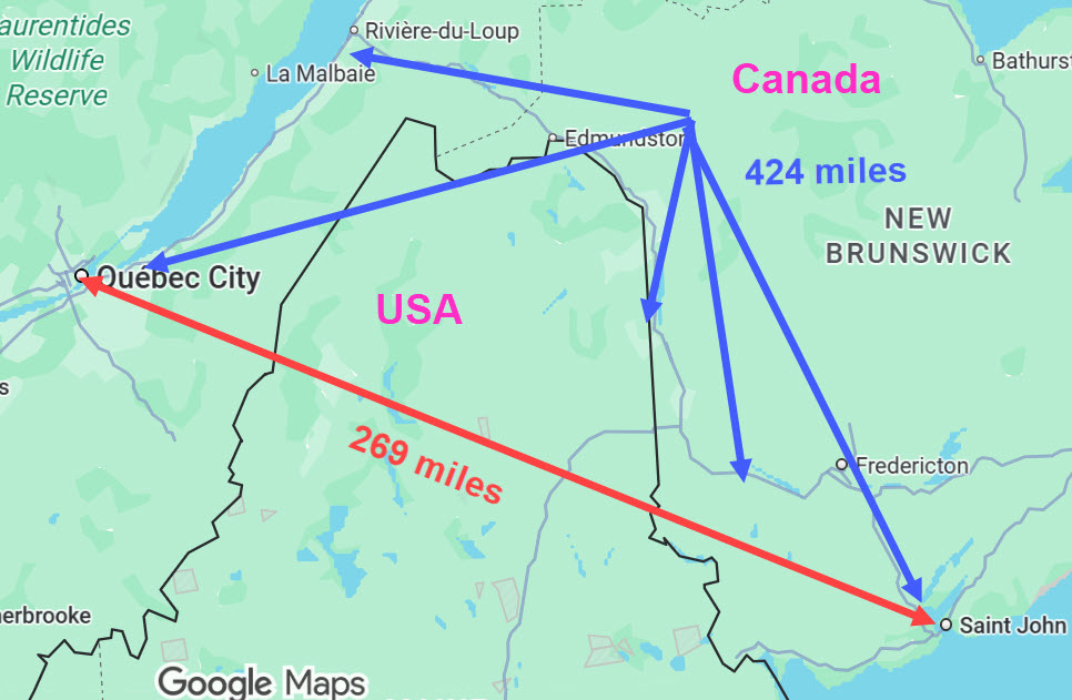
Two lanes each side for almost the entire journey today – 424 miles. Initially Apple maps showed 226 miles, but that was the distance as the crow flies. This is because of the “Battle of The Bulge”, where the US state of Maine pushes up between the Provinces of Quebec and New Brunswick, with no easy way to cross Maine at that point – there’s no choice but to go around it.
Driving through Quebec I was surprised at how agricultural it is. My great-great-grandfather would have got off the boat Quebec and probably got granted some farming land, as was common at the time. Later they moved to Grenville West of Montreal and finally to Sault St Marie in Ontario.
All signs now are solely in French and everywhere I go folks speak French to me, not English at all.
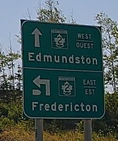
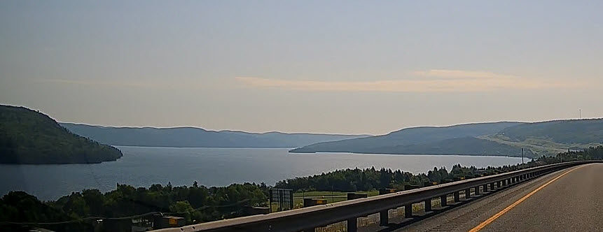
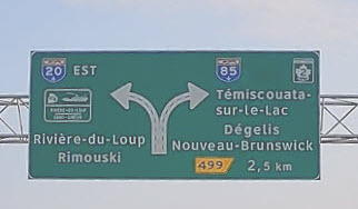
Soon I was driving alongside Lac (Lake) Témiscouata with the sun more to my left, which meant that I had “turned the corner” of my right angle journey from Quebec to New Brunswick, which I would enter in ~ 30 kilometres. There was no sign to tell me I was leaving Quebec and entering New Brunswick, the only clue being that road signs were now in both languages.
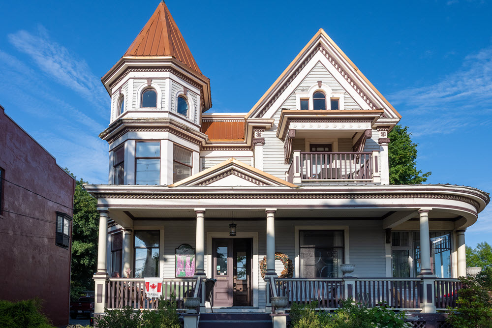
St. John NB is full of one way streets but, with a noticeable scarcity of signs, come to a junction and it’s best to look at which way all of the vehicles are pointing and follow their lead! The street my accommodation was on was in two halves, so naturally I went up and down the wrong half looking for it. It was a beautiful old single family mansion, called Mahogany Manor, built between 1902 and 1905 by William Cross, a local Saint John businessman who was a deacon in the Germain Street Baptist church next door. It’s been converted to a boarding house, but it still contained much of the old furniture as if it was still an old family mansion. Look at today’s media to see many more shots of the interior of the house.
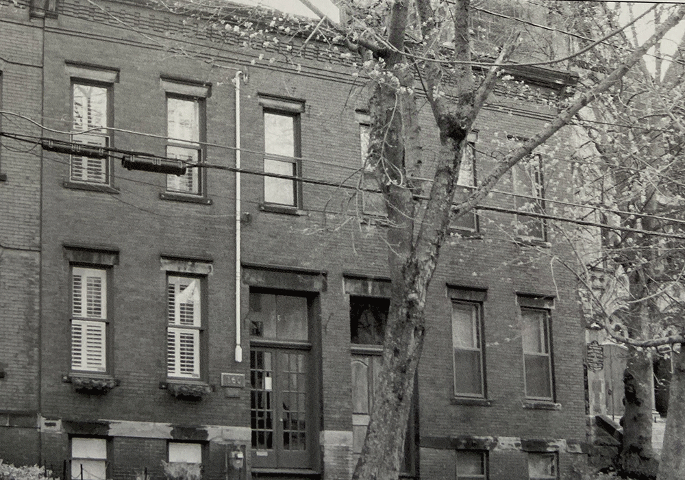
The afternoon was dedicated to finding the house where my wife’s grandfather was born here in St. John New Brunswick.
I had previously retrieved both his birth certificate, which doesn’t show the house where he was born, his birth register entry which does show the house but is illegible and finally the doctor’s return to the Registrar which showed clearly the exact address. I was determined to locate the house and take some photos to show my wife and her family.
I had briefly mentioned to the owner of the B&B I was staying in that I was searching for this specific house and why. He smiled and then disappeared, only to return later with a book.
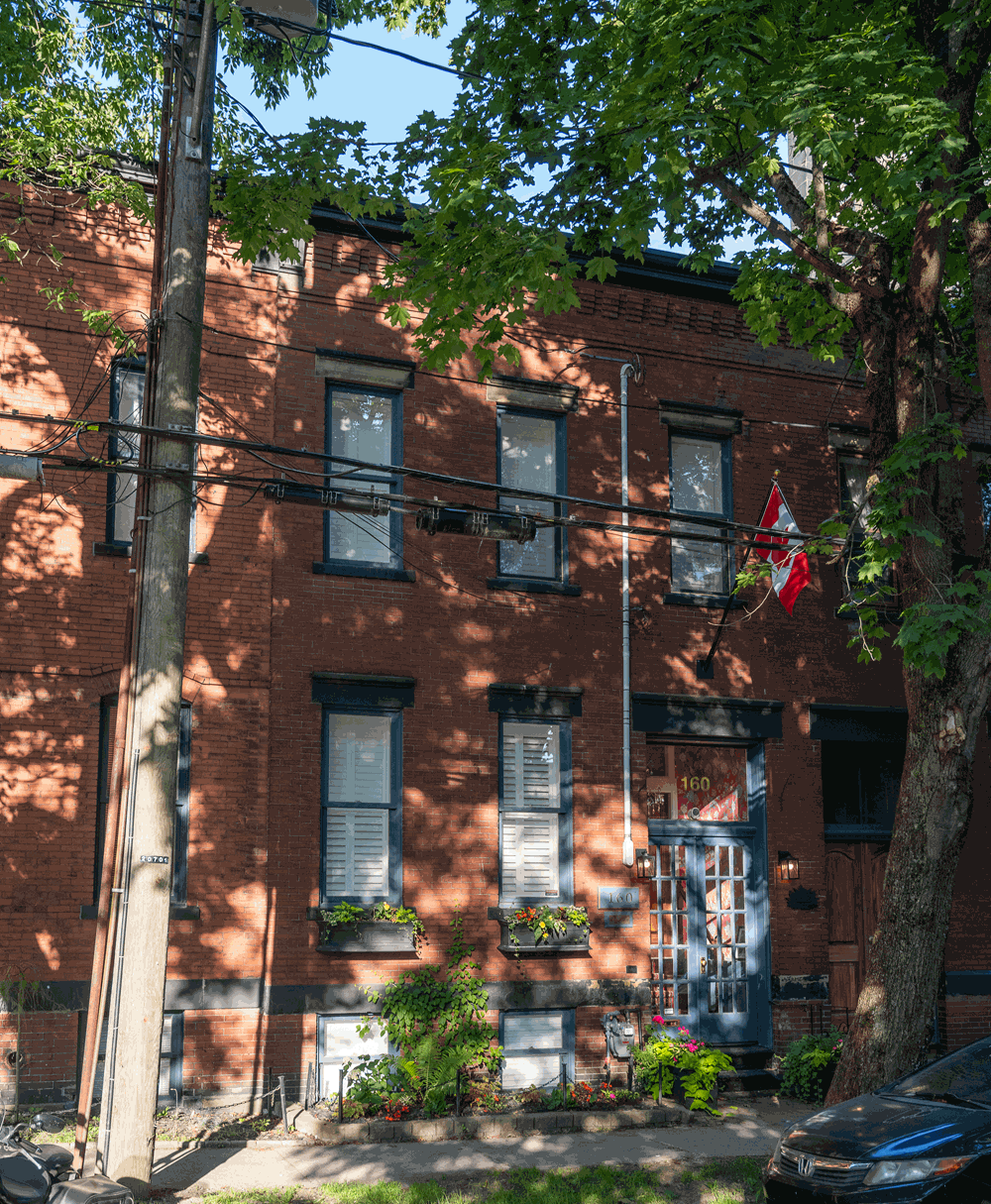
That "book" was a huge Volume I of a two part set, which gave a very detailed history of all of the historically important buildings in St. John. It was open at the page for the house I was looking for and gave the history of who built it (my wife’s great-grandfather) and when. In fact, he built two houses, not one, but only lived in one of them. The image above on the right is how the house looked shortly after it was built in 1889. It is the left hand house of the two. The family stayed in the house until 1935.
The next thing to do was to find the street that the house was on, so I asked my host if he could give me directions to Germain Street. "Certainly, you're standing on it now. Go out of the front door, turn right and walk about 300 metres!". The image to the right shows what the house looks like today.
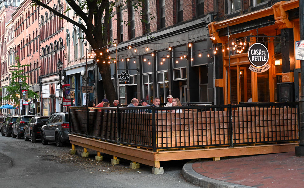
I decided that after all that effort I would treat myself to a slap up dinner at Britts, a short walk from the B&B and almost on the harbour front. It had a pavement terrace which was full of diners, and the interior was fascinating for it’s artwork on the brick walls.
It’s in the Brodie Building which was built in 1878 and the ground floor was the studio of a very famous Canadian painter called Miller Brittain, hence the name Britts and those paintings on the walls. You can see the pavement terrace and one of the paintings on this page, but there are more images, including another painting, on today’s media page.
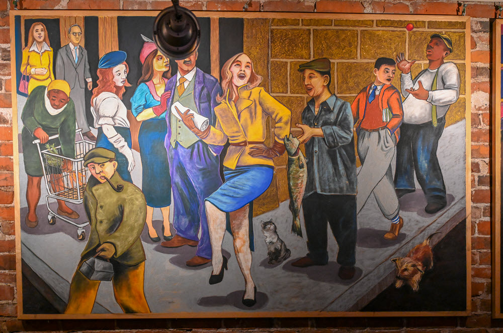
During this trip I have been blown away but how more expensive accommodation and food has been, and it seems to correlate with the fact that Canada has had a large increase in overseas visitors and Canadians taking their vacations in Canada. And that applied to this dinner! A steak, and not a particularly large one, cherry crumble, a couple of beers and a tip was over CA$100 though the food and service were excellent.
But at least I got to walk around town and one of the harbor areas and take some interesting shots. Here’s an evening harbour panorama.
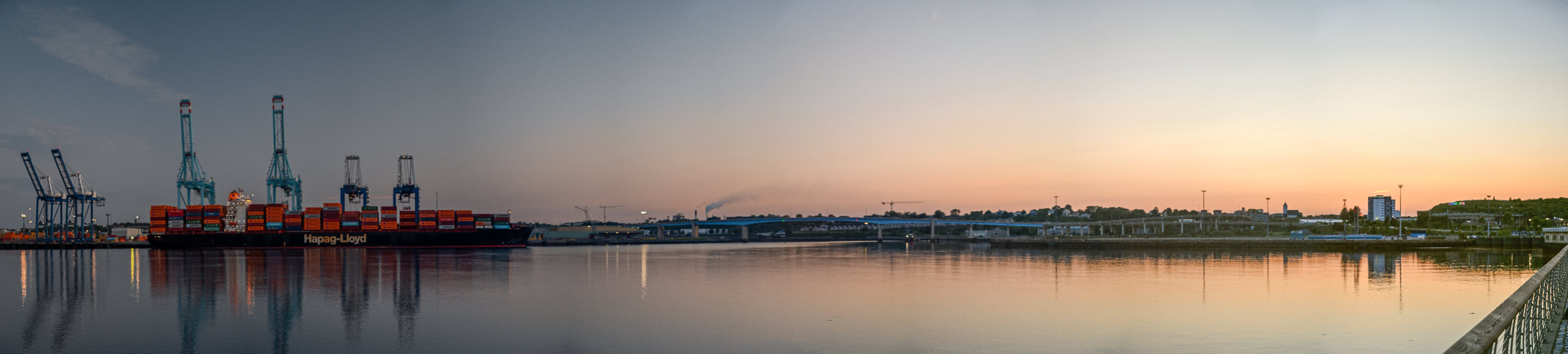
There are many more shots in today’s media.
Today was dedicated to finding my wife’s maternal grandfather family graves here in St. John New Brunswick.
I knew from my prior research that the family was buried in the Fernhill Cemetery in St. John, and like many other cemeteries, it is located on the outskirts of town, though when it was created in 1848 it would have been really “out of town”. I couldn’t get a map off the web, so I called into the office and asked if they could let me have one. I ended up looking at every grave in a very large section, but I did eventually find the family graves.
I initially took photos with my iPhone, but it was extremely hot for St. John (~31C) and I had got quite toasted walking through the plots. It was very difficult to see what I was shooting and to make things worse, the sun was very strong and naturally from the wrong direction! When I got back to the B&B and looked at the photos on the iPhone, they were not the best I have ever taken and I’m sure having my thumb in some of them didn’t help. So, later in the afternoon, when it was cooler and the sun was cooperating, I drove back to the cemetery and shot again, but this time with my Nikon Z7ii.
There is no media for today as all of the photos are of my wife’s family graves and it is very important to respect the family’s privacy.

There were lots of one way streets in St John, but I don’t remember seeing any signs indicating a one way street. Sometimes I’d go down a one way street, cross a four way junction and suddenly find myself in a two way street with no warning! Not for the faint hearted. To be fair, New Brunswick does have One Way street signs – the one on the right is lifted directly from their Road Signs Manual. These signs are placed horizontally to indicate direction of travel, but if you are already on the one way street, you can’t see them as you approach a junction. I couldn’t find one that faced the direction of travel.
Dinner was from a local supermarket and didn’t amount to much because I had far too much to eat yesterday evening!
Early to bed anticipating an early departure tomorrow morning.
Will be posted soon.
Will be posted soon.
Will be posted soon.
Will be posted soon.
Will be posted soon.
Will be posted soon.
Will be posted soon.
Will be posted soon.
Will be posted soon.
Will be posted soon.
Will be posted soon.
Will be posted soon.
Will be posted soon.
Will be posted soon.
Will be posted soon.
Will be posted soon.
Will be posted soon.
Will be posted soon.
Will be posted soon.
Will be posted soon.